
Wisconsin Point Resiliency Study Overview
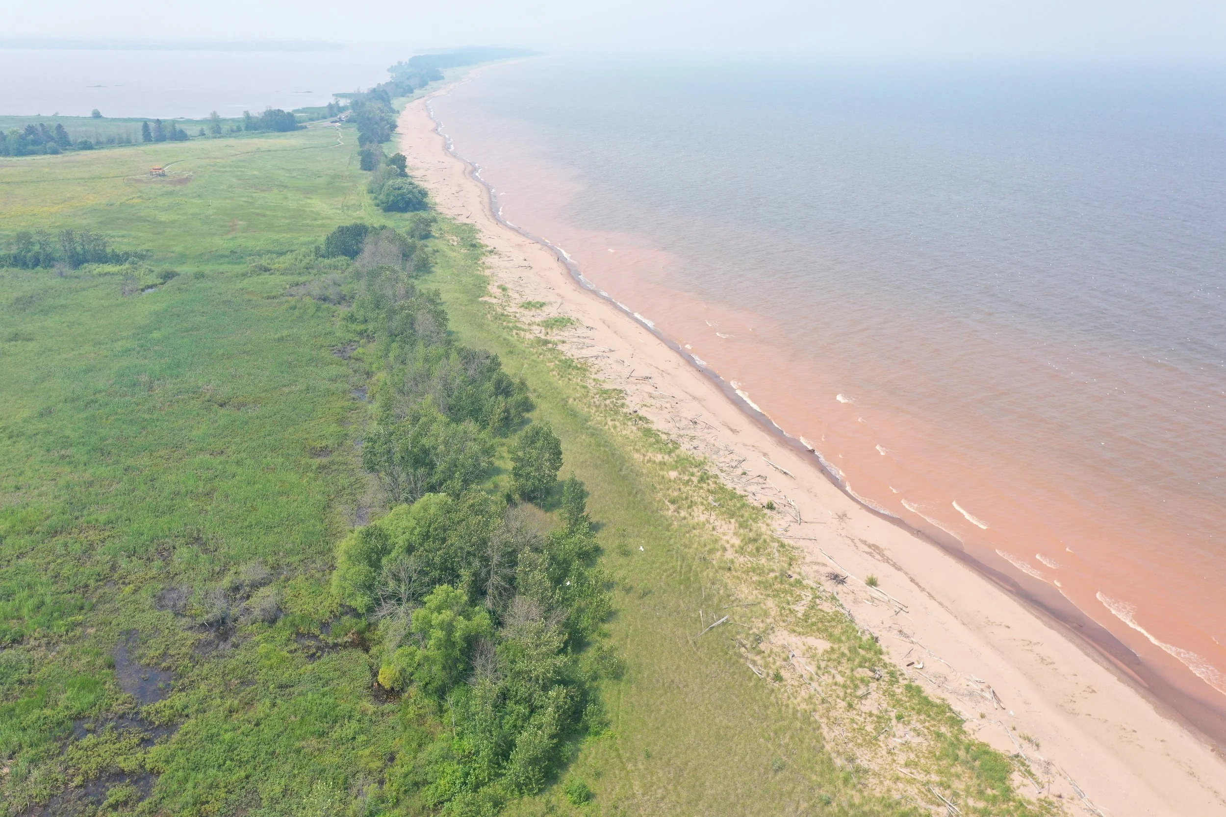
Drone image of Wisconsin Point, provided by AMI Consulting Engineers, PA
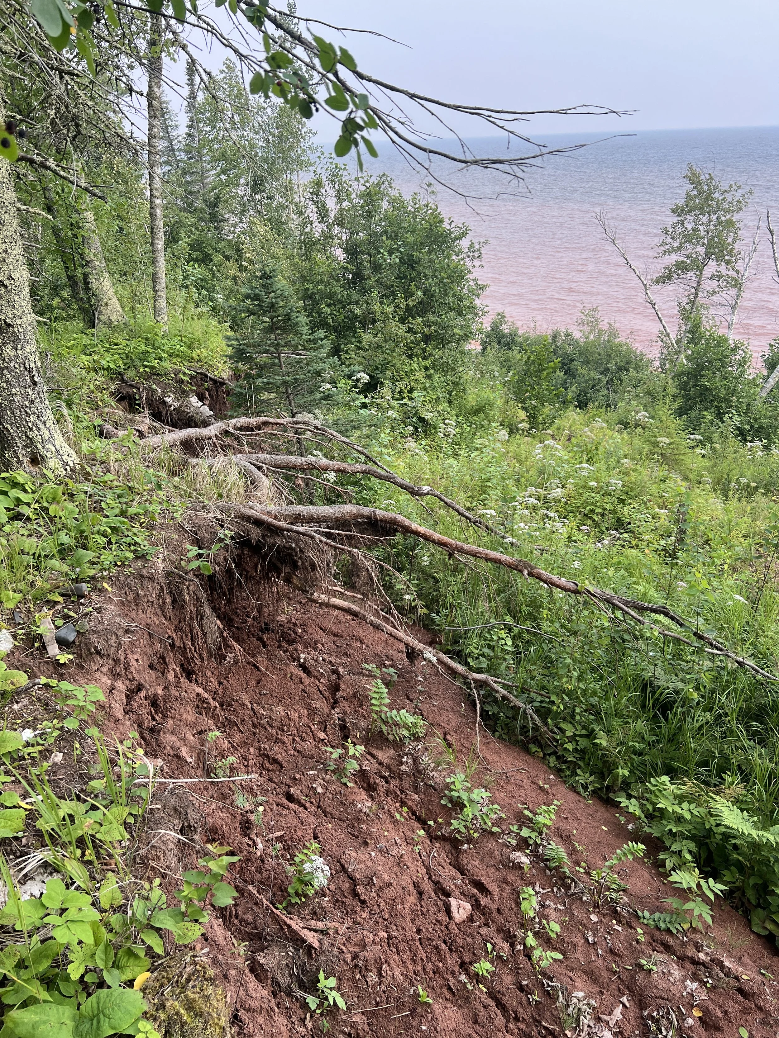
Image of erosion on Wisconsin Point, provided by AMI Consulting Engineers, PA (2025)
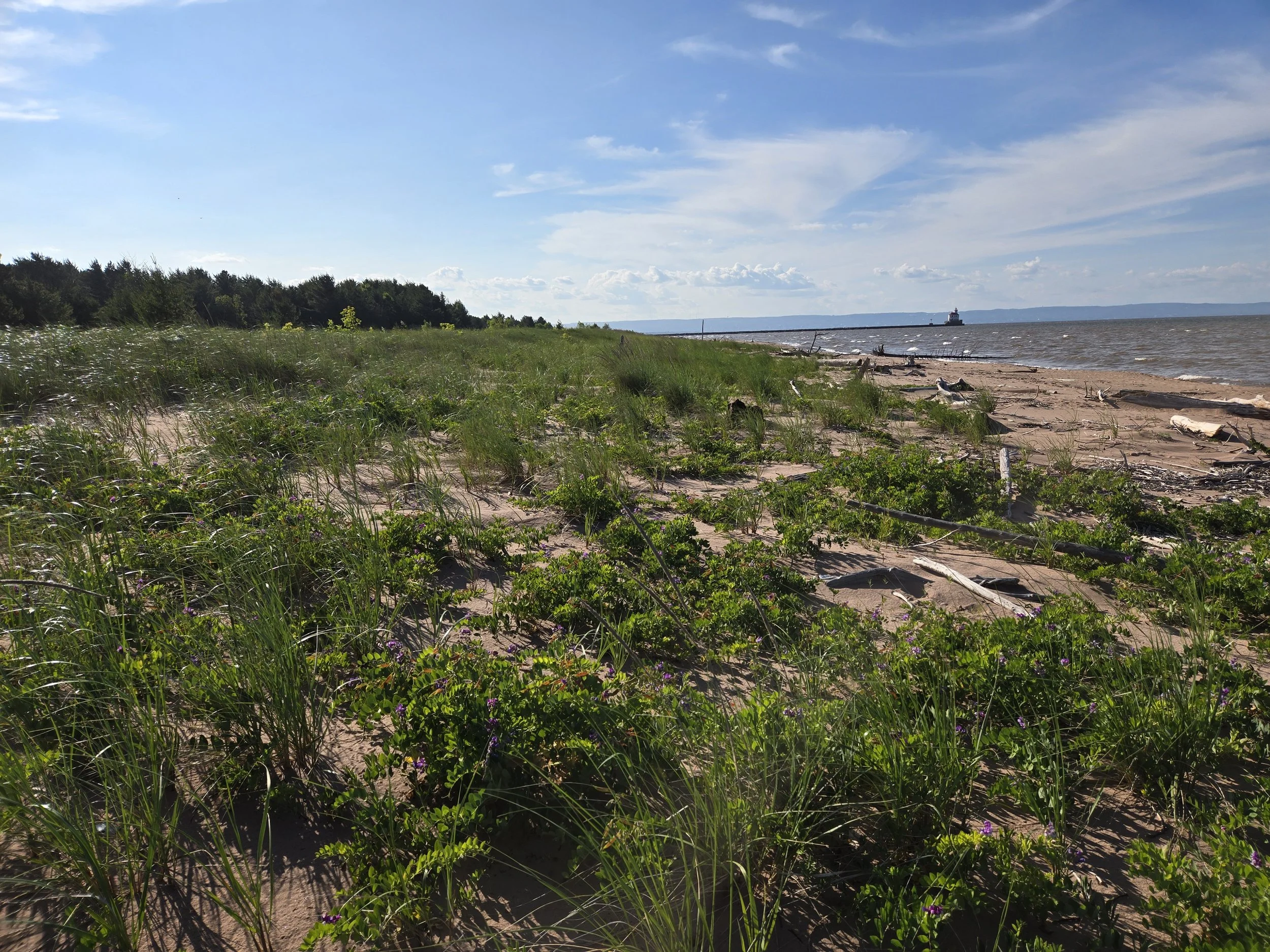
Image of dune habitat on Wisconsin Point, provided by AMI Consulting Engineers, PA (2025)
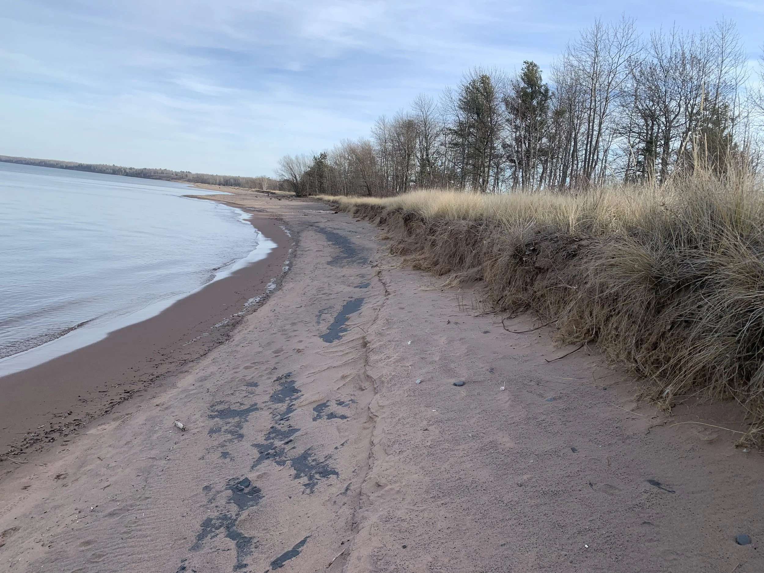
Image of erosion on Wisconsin Point, provided by Wisconsin Department of Natural Resources (2021)
Wisconsin Point is a four-mile freshwater sandbar located between Allouez Bay (part of the St. Louis River Estuary) and Lake Superior, just southeast of the City of Superior. It is an important place both environmentally and culturally. The area includes rare sand dunes and provides habitat for protected species such as the Piping Plover. Wisconsin Point is also deeply important to the Anishinaabe community.
In recent years, erosion (the wearing away of land by water and wind) has increased along Wisconsin Point. This erosion threatens natural habitats and cultural resources. To better understand what is causing the erosion and how to address it, the Wisconsin Department of Natural Resources (WDNR) partnered with other Great Lakes agencies and hired AMI Consulting Engineers, PA to study the shoreline and develop possible solutions.
2025 Field Studies
During the summer of 2025, the AMI project team collected detailed information to better understand how the shoreline is changing. The study looked at land conditions, water movement, plant communities, and sand movement.
The team completed the following work:
Surveyed the beach and dunes to measure elevations and track changes over time.
Mapped the lake bottom near shore to understand underwater shapes and how sand moves.
Studied vegetation and habitat to understand the health of dune plant communities.
Collected sand samples to analyze grain size and composition.
Used drones to create detailed maps of current shoreline conditions.
Two monitoring stations were also placed offshore in Lake Superior to collect ongoing data.
A floating buoy measured wave height, wave direction, wave timing, and weather conditions.
An instrument placed on the lake bottom measured water currents and additional wave data.
Together, these tools helped the team understand how waves, water levels, wind, and currents affect the shoreline.
Modeling and Next Steps
The information collected in 2025 is now being used in computer models. These models simulate how waves, wind, water levels, and moving sand affect shoreline stability under different conditions.
By combining field data with modeling, the team can:
Identify areas most at risk of erosion.
Estimate how severe erosion could become.
Explore possible future shoreline changes.
The results will help guide the development of potential shoreline protection strategies. The focus will be on nature-based approaches and long-term, sustainable solutions.
Community input will also be an important part of the process. AMI will work with the St. Louis River Alliance to host community engagement sessions to gather feedback from residents, stakeholders, and visitors. Sign up for SLRA’s newsletter to learn about our new River Revival event series happening in Superior come April!
The project will also consider findings from the City of Superior’s visitor use assessment to understand how people use and access Wisconsin Point.
By combining science, community input, habitat protection, and recreation needs, the project aims to develop solutions that are environmentally responsible and responsive to community priorities.
Final recommendations will be shared with the WDNR and partner agencies for further review and evaluation.