
Allouez Bay & Wisconsin Point
Restoration Projects
Connecting the Community
Your stories, ideas, and dreams will help guide how future restoration projects take shape—including how to make access easier, safer, and more welcoming for everyone.
How do you connect with Allouez Bay and the St. Louis River? What do you love about Wisconsin Point? Several restoration efforts are underway in these areas and the St. Louis River Alliance (SLRA) is working with project partners to connect with Superior residents and better understand what these places mean to the community.
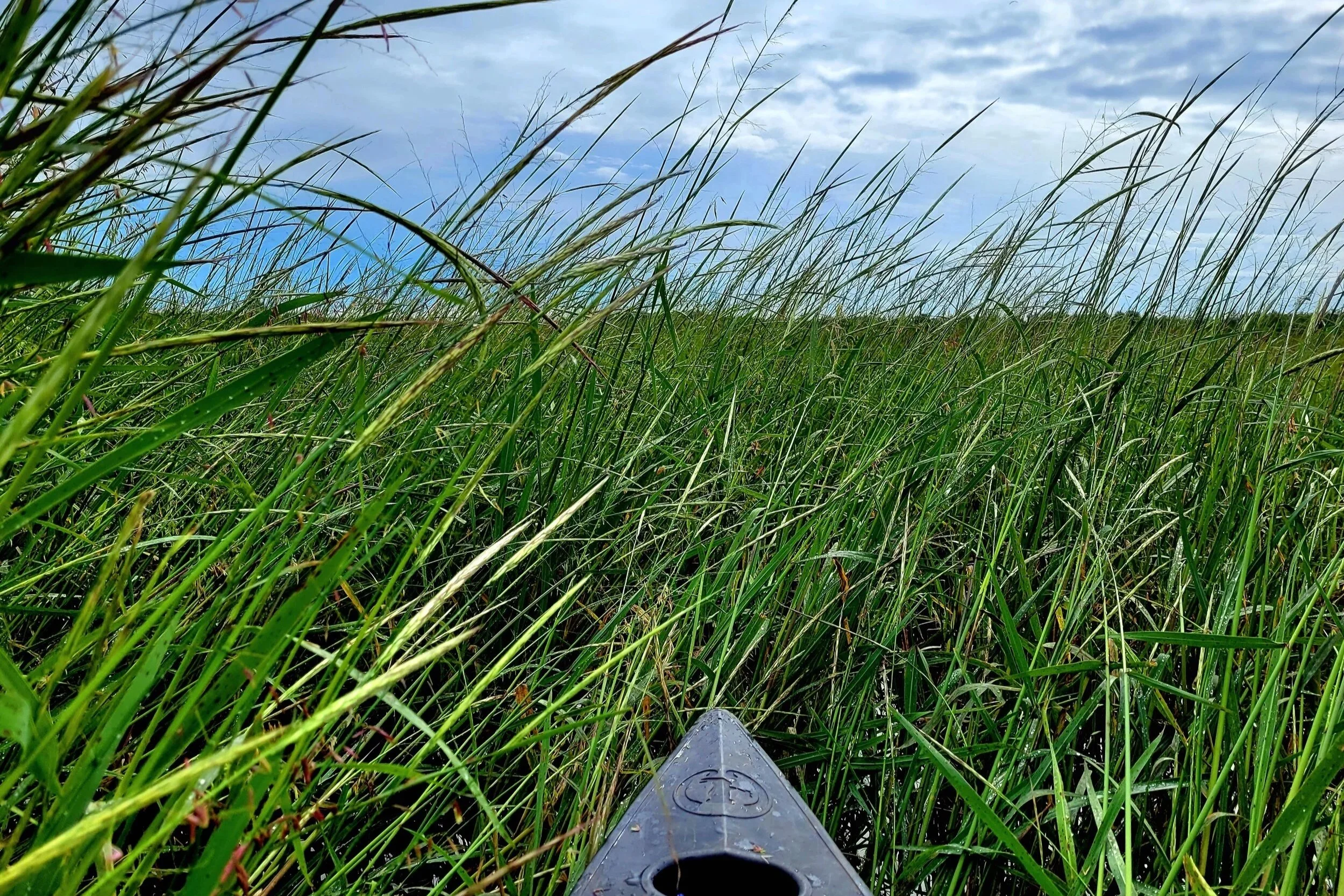
Whether you fish, paddle, hike, birdwatch, or simply enjoy the view, your perspective matters. We want to learn how you use and value Allouez Bay and Wisconsin Point, what you'd like to see in the future, and what challenges may be limiting access or enjoyment.
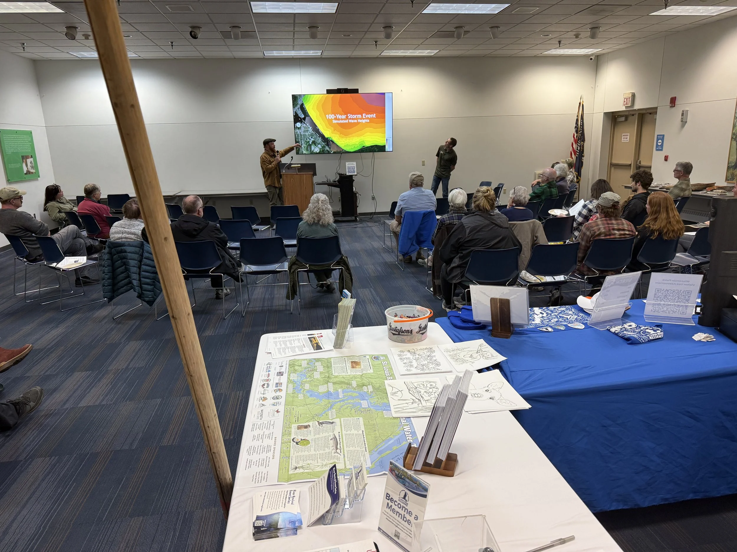
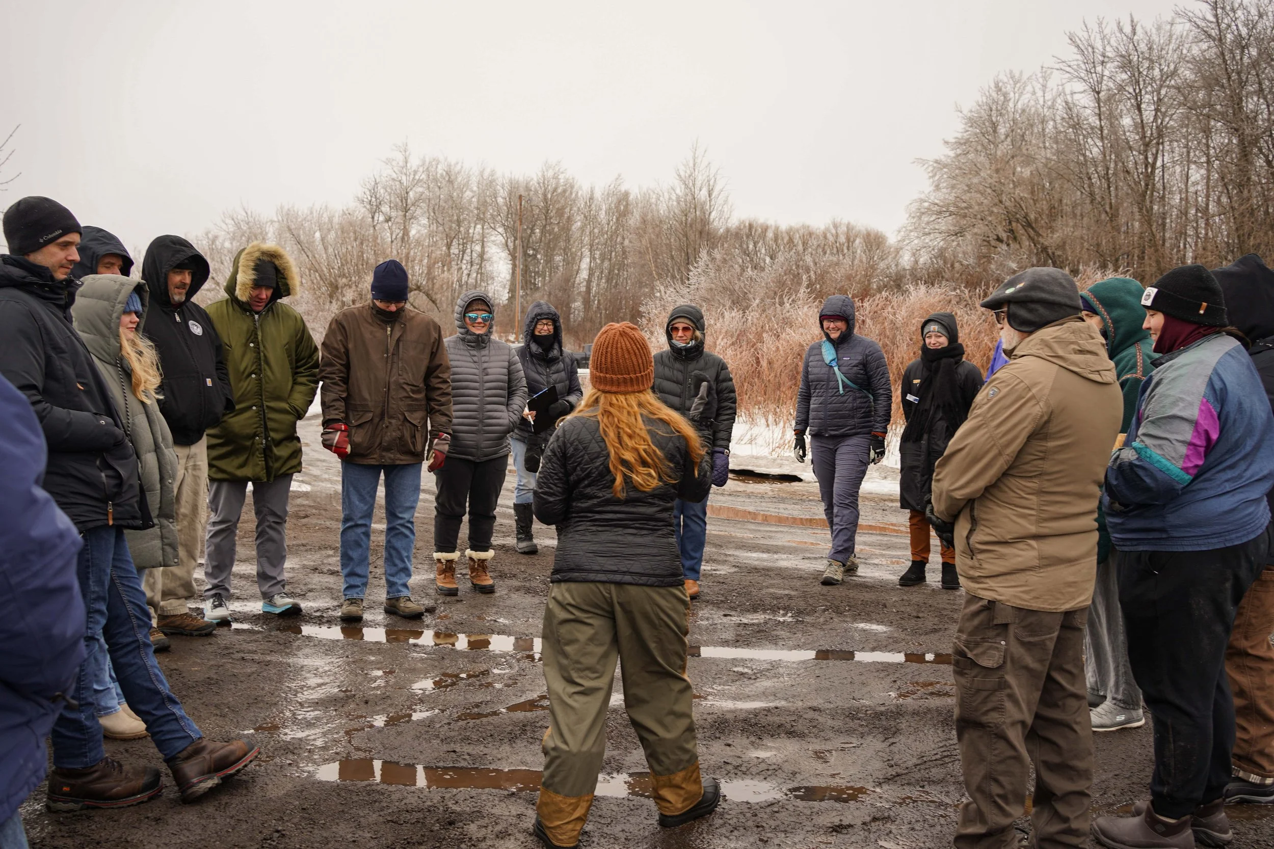
Over the next two years, SLRA will be participating in local events and hosting activities throughout the area to gather community input. Together, we're building a shared vision that honors the past, respects the land and water, and supports healthy spaces for both people and wildlife.
This community engagement effort is supported through Great Lakes Restoration Initiative (GLRI) funding granted to the Wisconsin Department of Natural Resources (WDNR) to collaborate with the Minnesota Land Trust and the St. Louis River Alliance in engaging local communities.
Continue reading to learn about the projects at hand and how you can get involved.
Quick Links
Current Projects


Location
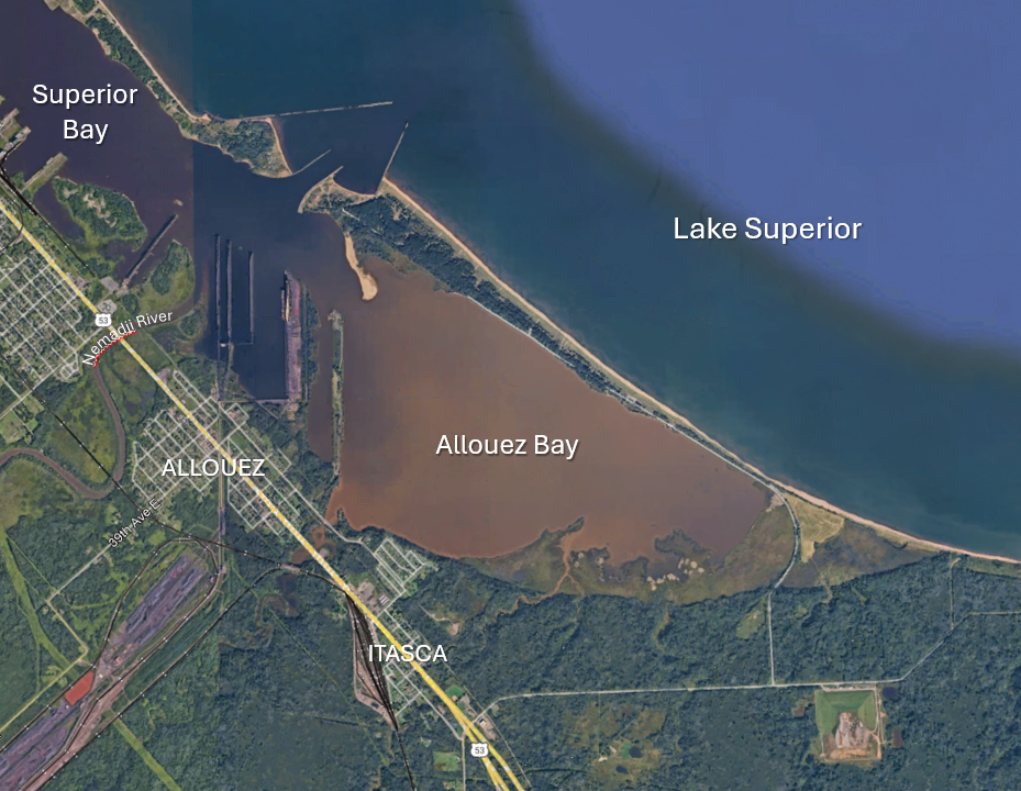
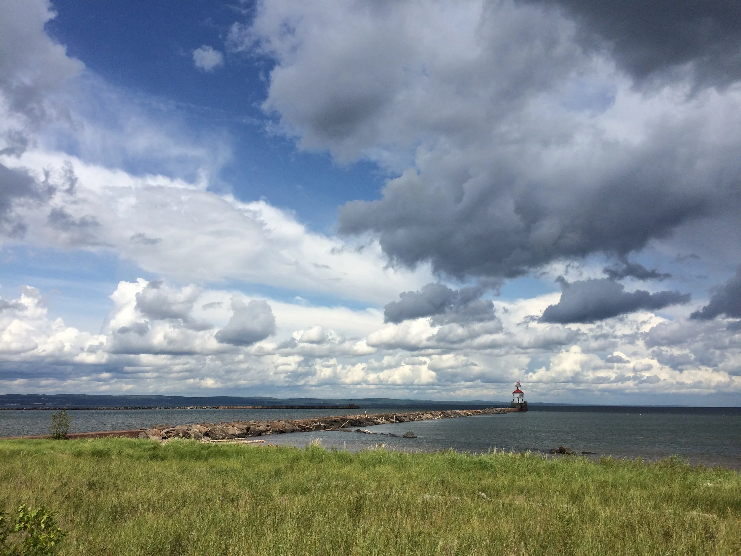
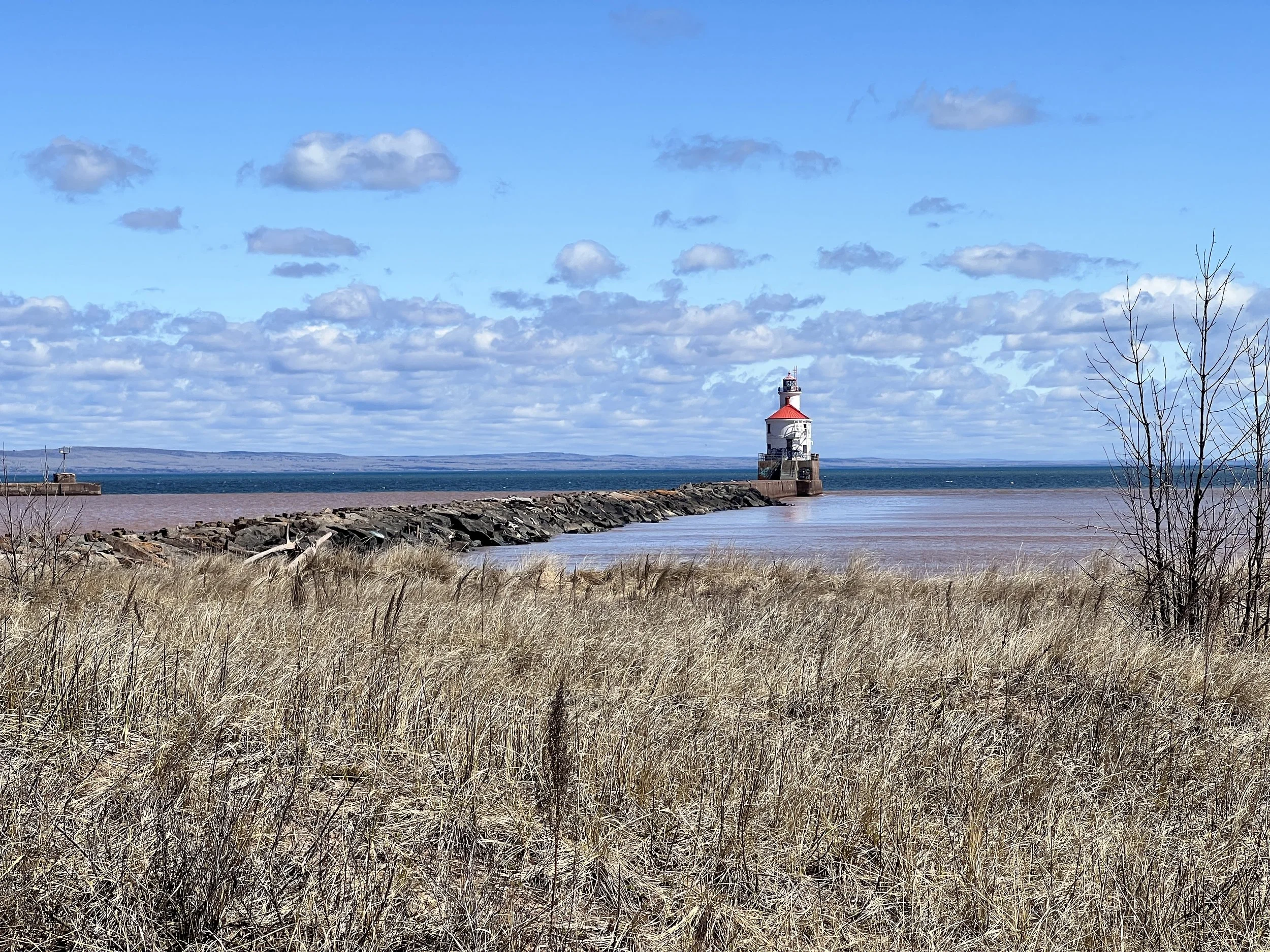
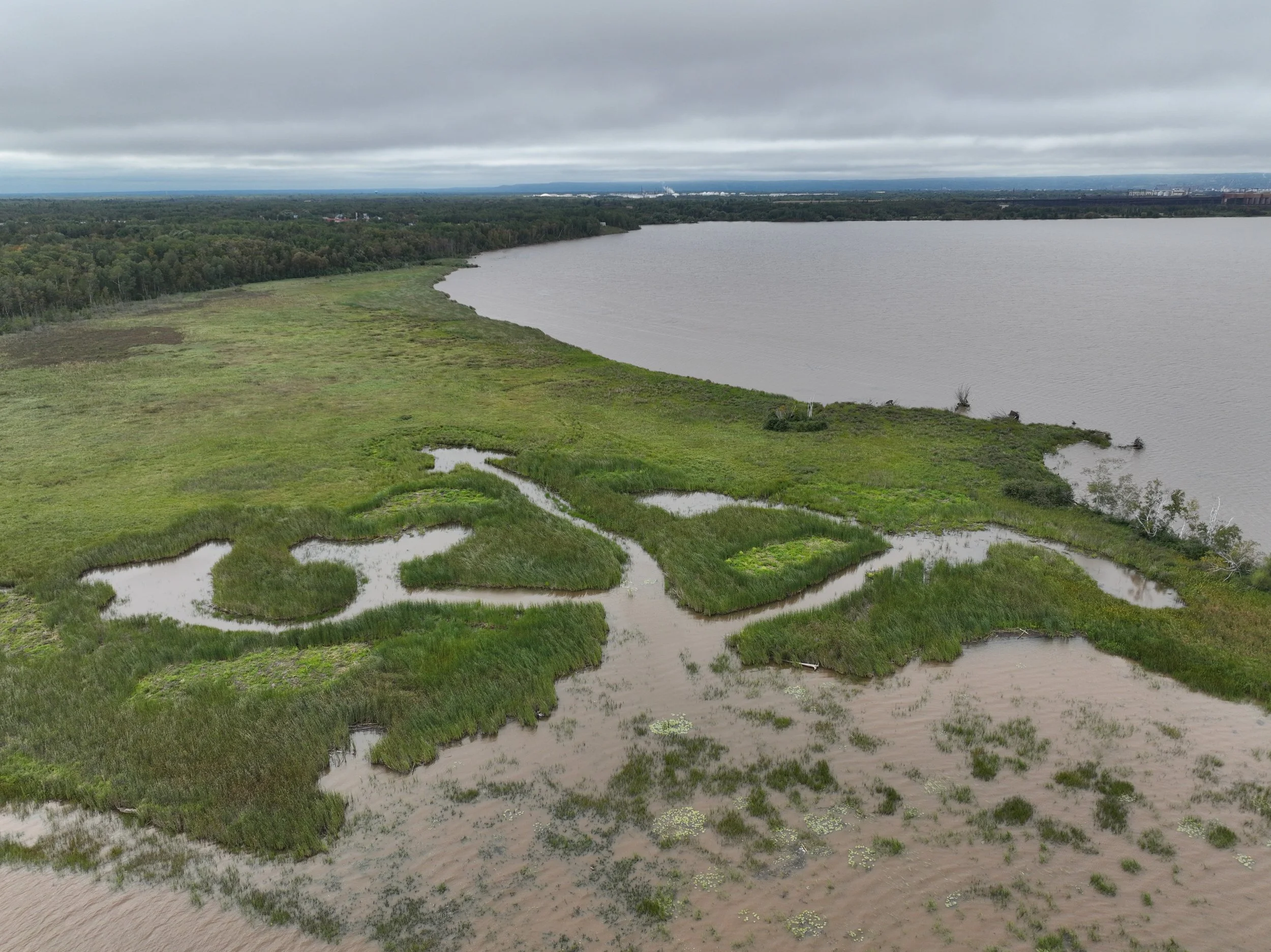
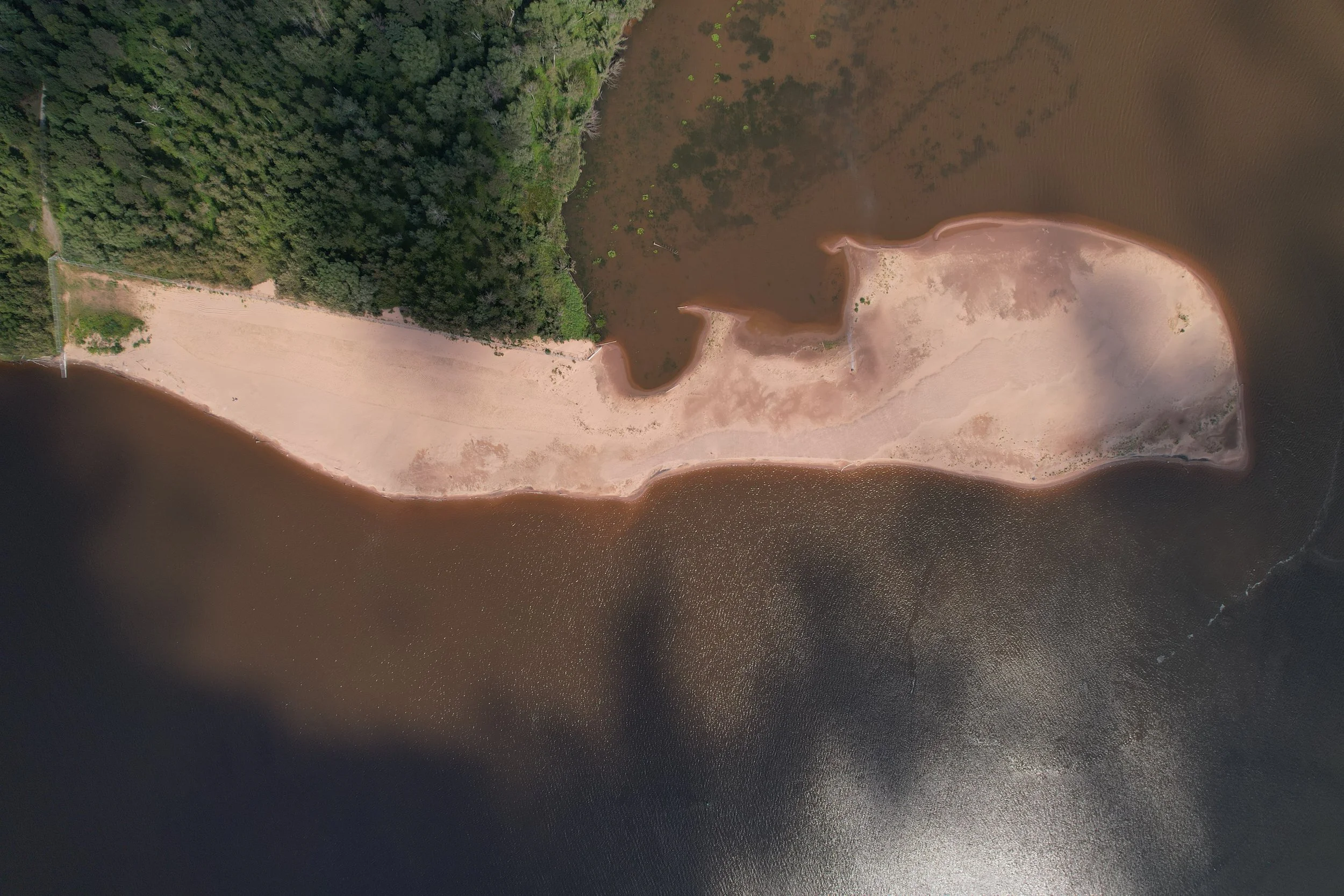
Wisconsin Point and Allouez Bay are special places near the Allouez and Itasca neighborhoods in the city of Superior, Wisconsin, located where the St. Louis River flows into Lake Superior. These areas are important not just for people, but also for many species of native fish, plants, and wildlife. Wisconsin partners are restoring and protecting these places for future generations.
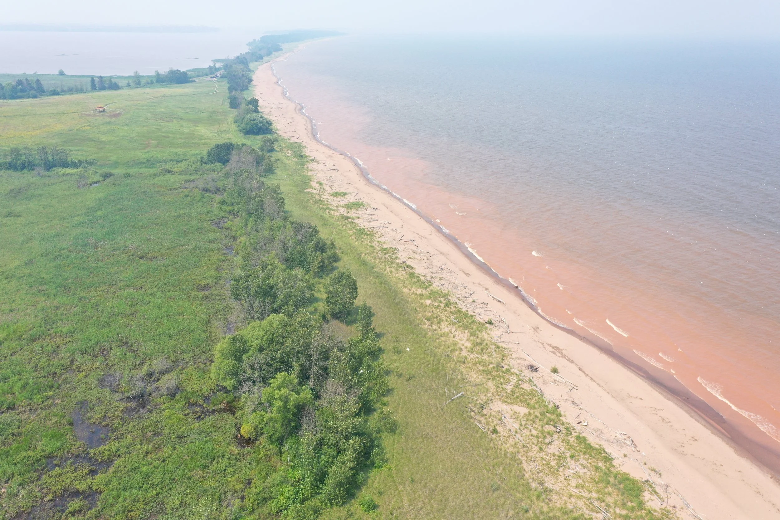
Together with Minnesota Point, Wisconsin Point is part of one of the largest freshwater baymouth bars in the world. This long, narrow strip of sand formed from river sediment (mud, sand, etc.) building up over thousands of years since the last ice age 10,000 years ago.
Today the strip of narrow land, Gibiskising Minis (land bridge) in Ojibwemowin, marks the boundary between the river and the lake. Allouez Bay is located at the southeastern corner of the estuary at the mouth of the sediment-rich Nemadji River, and adjacent to the Superior Entry, the natural opening between the river and the lake.
A Home for People
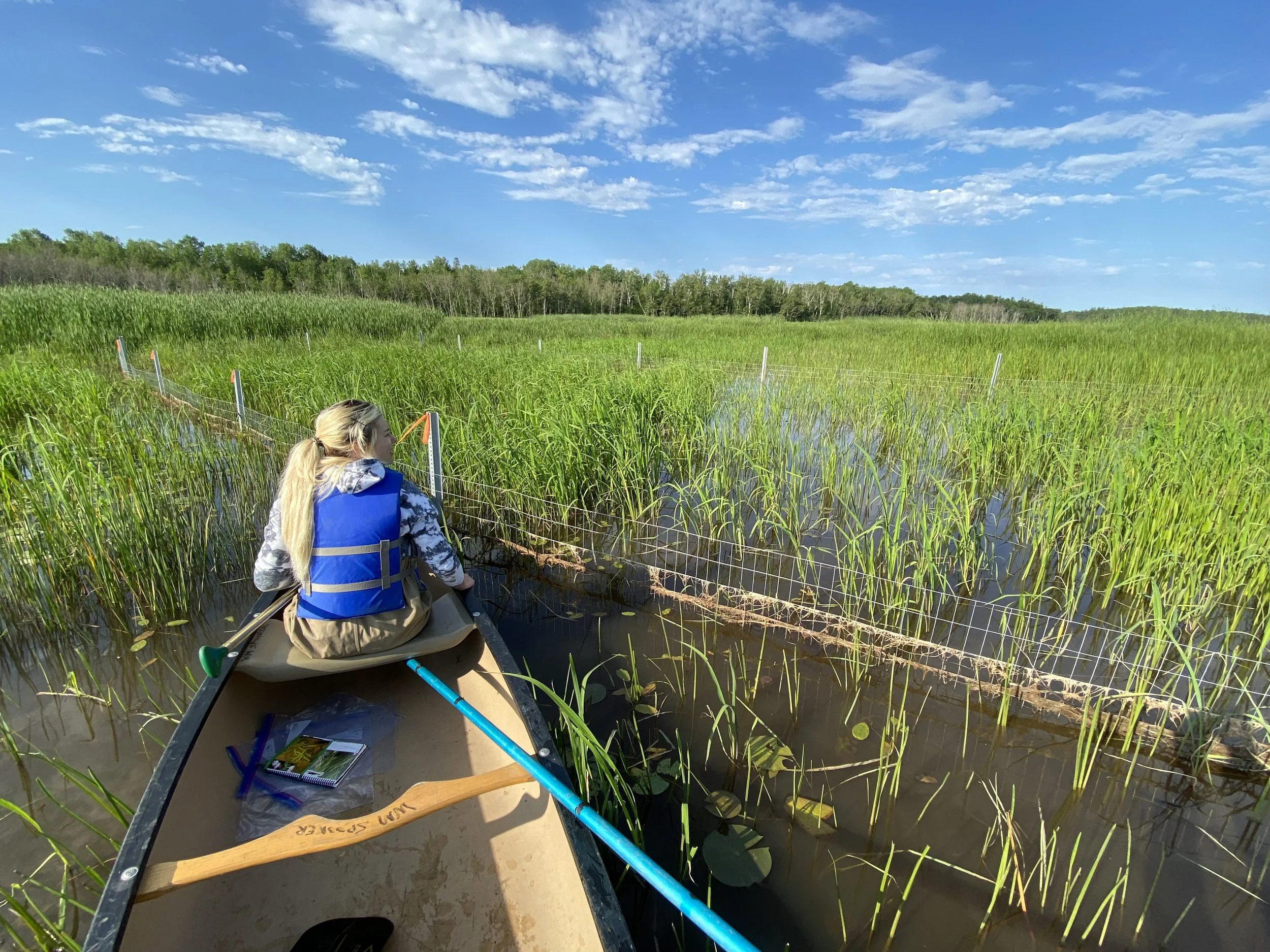
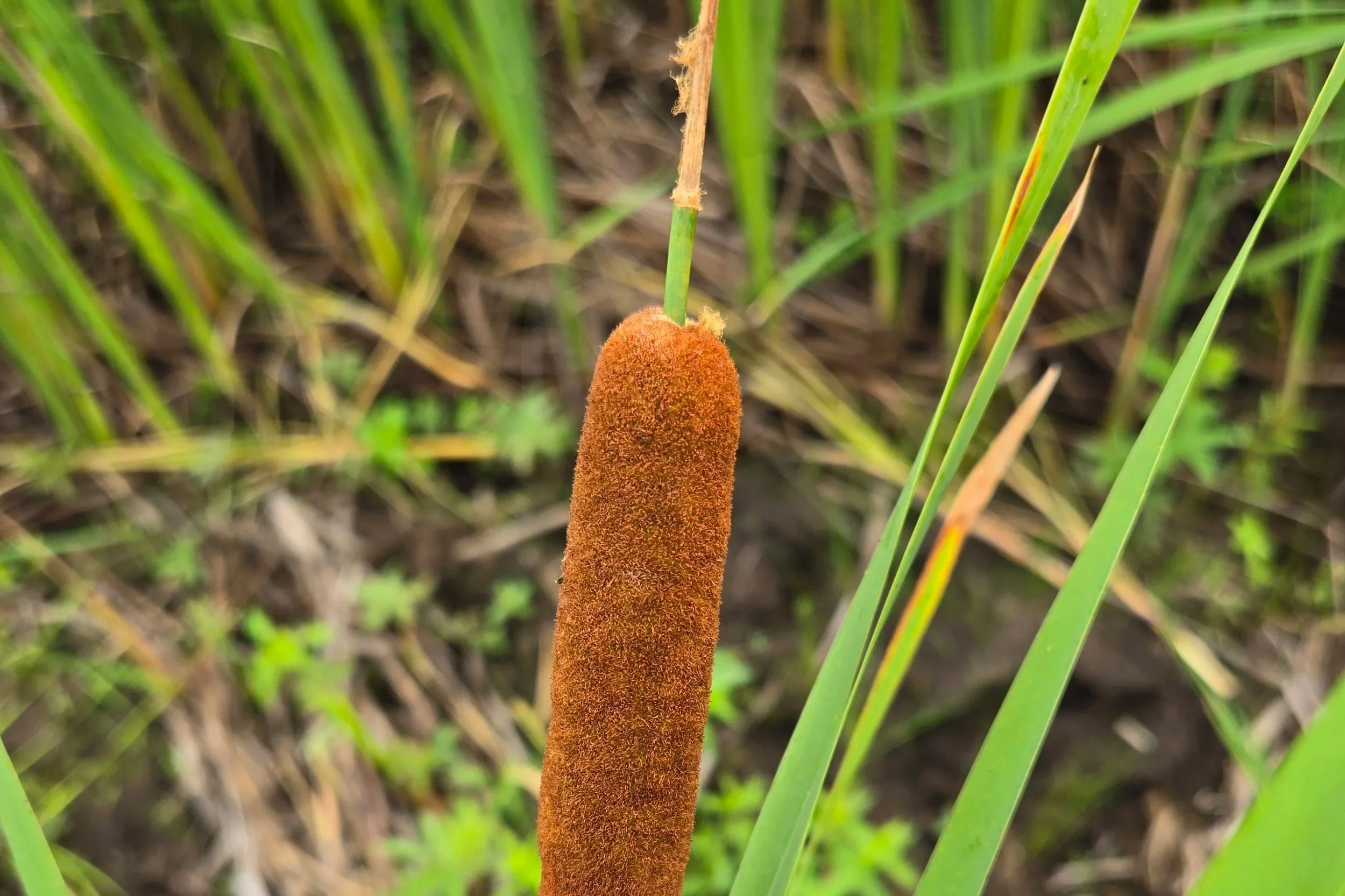
Photo: Seeding manoomin, or wild rice, in Allouez Bay.
Wisconsin Point holds major significance for Ojibwe people. On and around Wisconsin Point and Allouez Bay, Ojibwe people cared for a wealth of abundant blueberries, thick manoomin (wild rice) stands, red pines with pitch for building canoes, other medicinal plants, and productive fishing areas. Wisconsin Point was home to an Ojibwe village until the early 1900’s, when residents were displaced in response to plans for construction of a railroad and ore dock on the Point. Descendants of village residents and Fond du Lac Band of Lake Superior Chippewa members continue to honor relatives and ancestors at the site of a historic cemetery, which was largely disinterred and moved to St. Francis Cemetery in 1918. In 2017, a 10.9 acre parcel at the end of the Point was regained from the US Coast Guard by the Fond du Lac Band. In 2022, the cemetery area was returned to the Fond du Lac Band from the City of Superior.
Now, Wisconsin Point and the shores of Allouez Bay are protected as public lands owned and stewarded by the City of Superior, Douglas County, Fond du Lac Band of Lake Superior Chippewa, and the Wisconsin Department of Natural Resources. They are included within the boundaries of the Lake Superior National Estuarine Research Reserve.
You can learn more about the stewardship and preservation of Wisconsin Point by reading through the Wisconsin Point Management Plan developed by the City of Superior. This Plan provides a long-term framework for protecting, managing, and restoring the natural, cultural, and historical resources of Wisconsin Point. It aims to balance ecological preservation with public access, education, and respectful use of this culturally significant landscape.
A Home for Wildlife

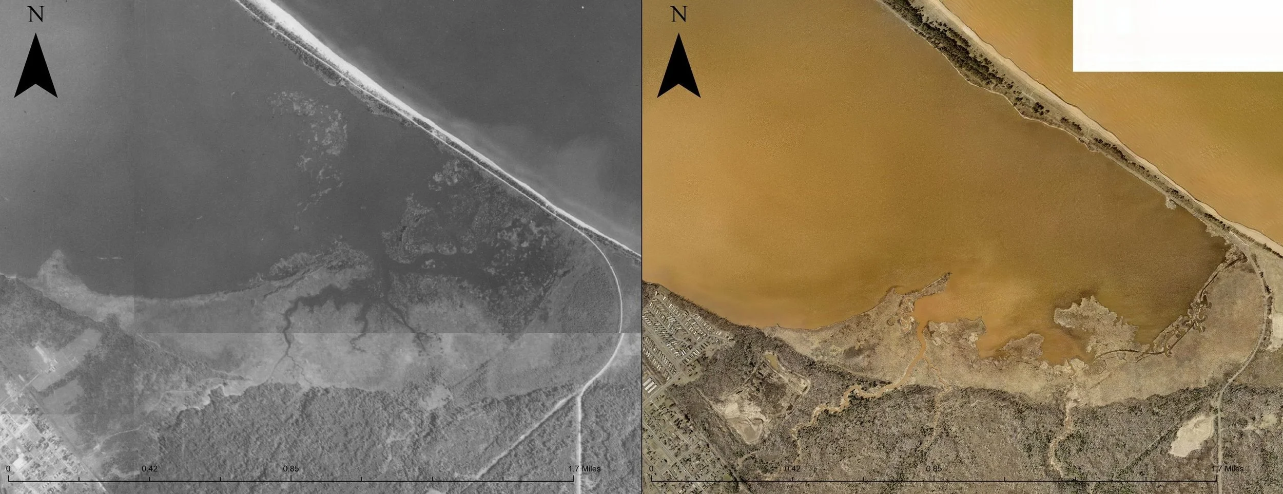
The above 1863 Hearding map (Bureau of Topographical Engineers of the War Department, 1863) is one of the oldest known maps of the St. Louis River estuary.
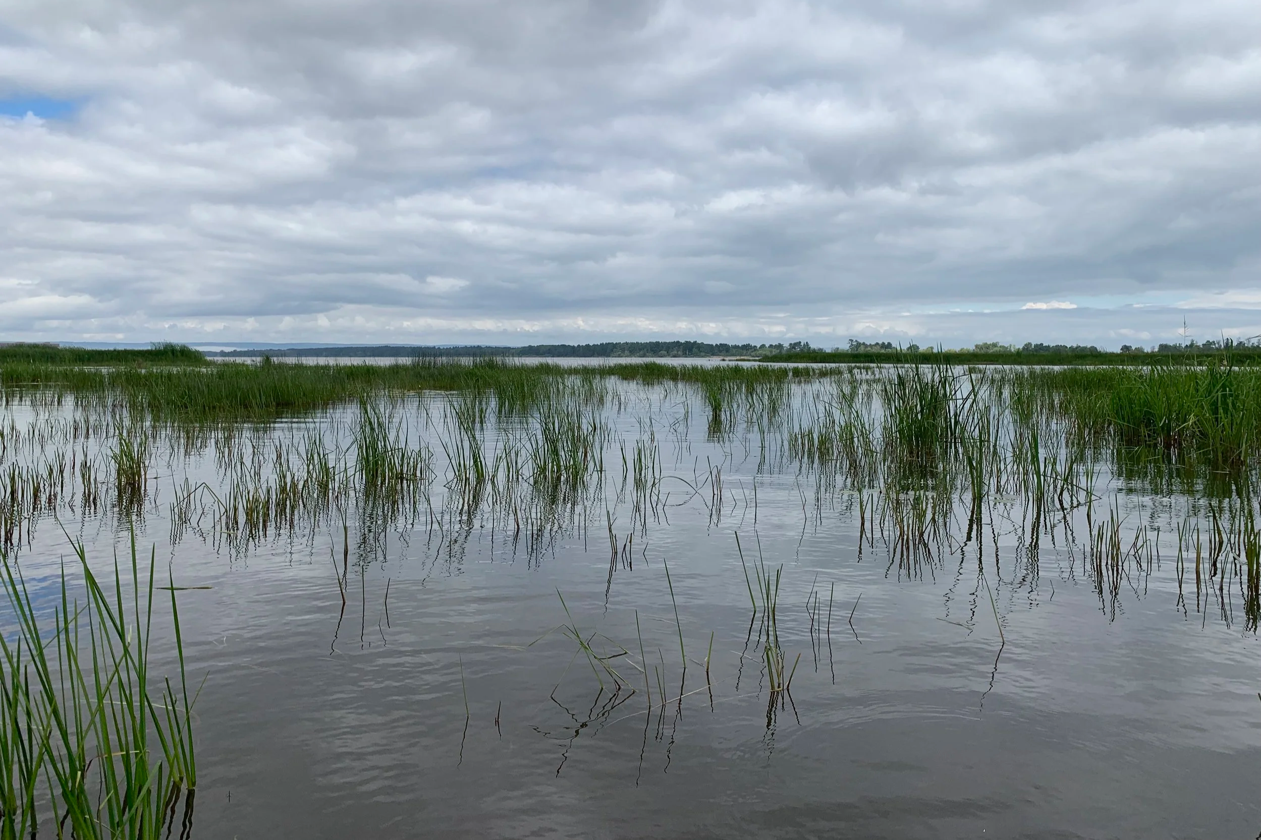
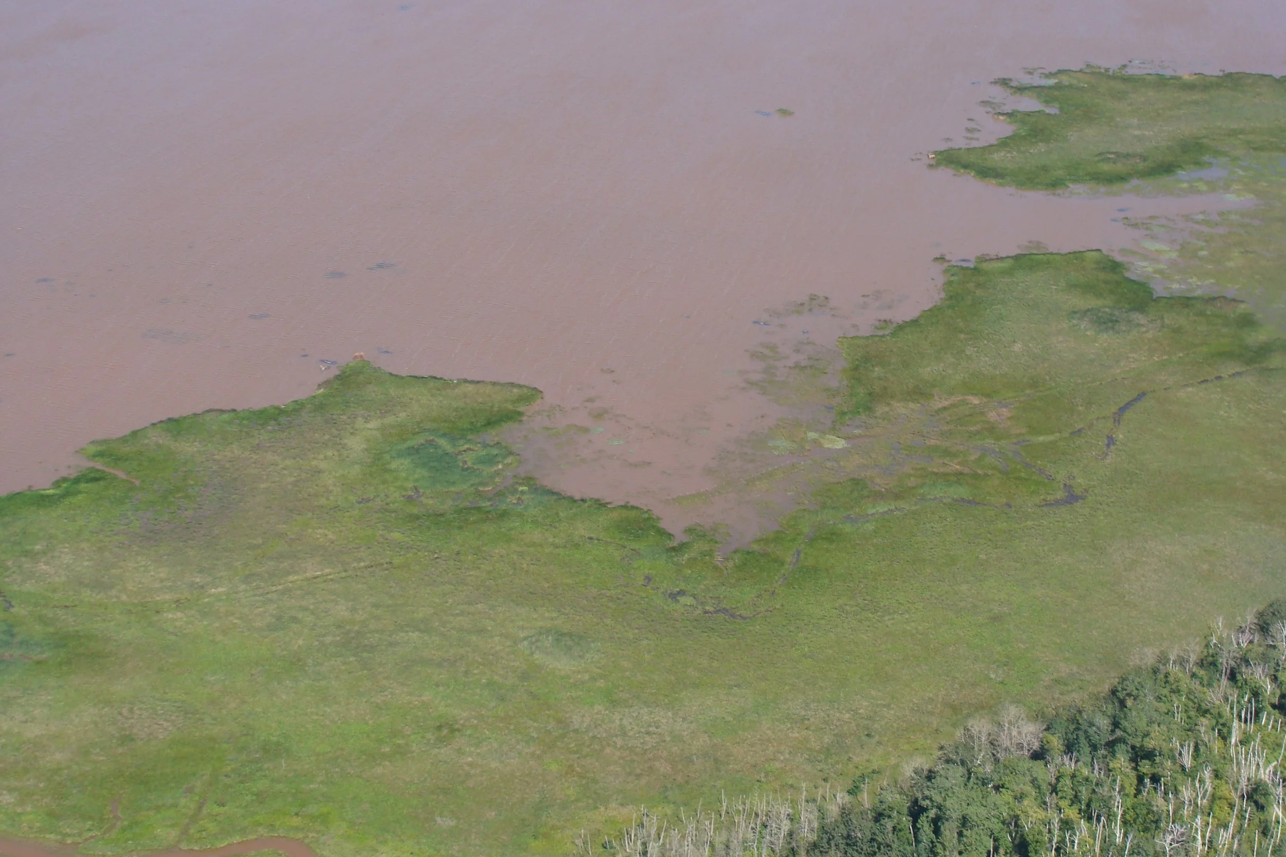
Allouez Bay has lost significant wetland habitat since European settlers first arrived in the region. The historic Hearding Map (left), drafted in 1861, shows much of the eastern portion of Allouez Bay was home to patches of tall native wetland vegetation interspersed with open water and crossed with branching water channels (hemi-marsh). Now, this area is largely open water, and remaining wetland areas have been colonized by invasive species like narrowleaf and hybrid cattail and purple loosestrife. These changes have had an impact on the wildlife species that use these habitats to breed.
The human impacts in Allouez Bay are part of a larger pattern of habitat loss in the area. Over 3,400 acres of coastal wetlands have been lost in the St. Louis River estuary due to impacts of historical pollution, development, dredging, and invasive species. These major habitat losses make places like Allouez Bay and Wisconsin Point even more important to protect and preserve. For example, while the area has experienced its own impacts, surveys in 2020 and 2021 showed that most breeding marsh birds are still present in Allouez Bay wetlands, albeit at lower density than expected. Because the area is undeveloped and in public ownership, it is an ideal place to protect and improve habitat for our greater-than-human relatives going forward.
Developing a Vision
In 2021, a group of natural resource managers and research scientists convened to develop a long-term, comprehensive vision for this area, with the help of community members. The effort was led by the Lake Superior Headwaters Sustainability Partnership, a broad coalition of agency and non-profit partners working to achieve a thriving estuary landscape and community. First, the group identified priority species that use or have used the area in the past, including birds (e.g., breeding marsh birds), fish, insects, reptiles, mammals, and plants (e.g., manoomin or wild rice). They then reviewed the best available data and information about the past and present ecosystem conditions on and around Wisconsin Point and Allouez Bay, relative to those species. Comparing these, the group identified data gaps, high quality areas to protect, locations in need of restoration, and other actions. Overall, the group identified a need to increase sheltered conditions in the bay to support more diverse and extensive marsh habitat for fish, birds, and wildlife in general.
After outlining these priorities, one of the partners, the Lake Superior National Estuarine Research Reserve, talked with Superior residents about their experiences and what they wanted to see in Allouez Bay in the future. Community members shared the losses and changes they’d observed in the area through time, some over multiple generations. Residents shared that they enjoy the hunting, fishing, gathering, and exploring opportunities that the ecosystem offers year-round. They value the beauty and undeveloped nature of the area, which they would like to see preserved. Community members also shared challenges to accessing the bay and expressed desire to see access points improved. One direct outcome from this community input process was the purchase of and upcoming improvements to Bunge Dock at 44th Avenue in Superior, which will help address some of the access needs described in the vision.
More broadly, community members articulated a desire for increased and continued community outreach and engagement as the restoration work moves forward. This is one of the reasons the St. Louis River Alliance (SLRA) is working to share this information and offer opportunities to provide input on projects going forward.

Based on these efforts, the Allouez Bay Restoration Vision above was developed. The vision is focused in three areas: protection, restoration, and access.
Protection: Prioritize protecting existing high quality habitat locations throughout the area.
Restoration: Focused on creating sheltered conditions that foster emergent (reaching above water) wetland plants mixed with open water habitat in the southeastern portion of the bay referred to as hemi-marsh, the habitat preferred by breeding marsh birds. For fish habitat, the vision includes ensuring tributaries to the bay allow fish passage and protecting or expanding deep water habitat in the middle of the bay.
Access: For people, the vision includes creating and improving access in the southwest portion of the Bay in adjacent neighborhoods.
The work to make this vision happen has already started!
Current Restoration Projects
There are several initiatives that are underway to protect this special place.
Allouez Bay Marsh Bird Habitat Restoration (Phase 1)
Hemi-marsh Creation & Cattail Management
The goal of this project is to improve wetland habitat structure in Allouez Bay to support marsh birds. Marsh birds prefer wetlands that include patches of tall native wetland vegetation interspersed with open water. The project will remove invasive species to recreate this appropriate habitat in existing wetlands in Allouez Bay.
Funding: Great Lakes Restoration Initiative
Lead Project Partners: Wisconsin Department of Natural Resources, Audubon Great Lakes
Fact Sheet: St. Louis River Estuary Allouez Bay Marsh Bird Habitat Restoration Project
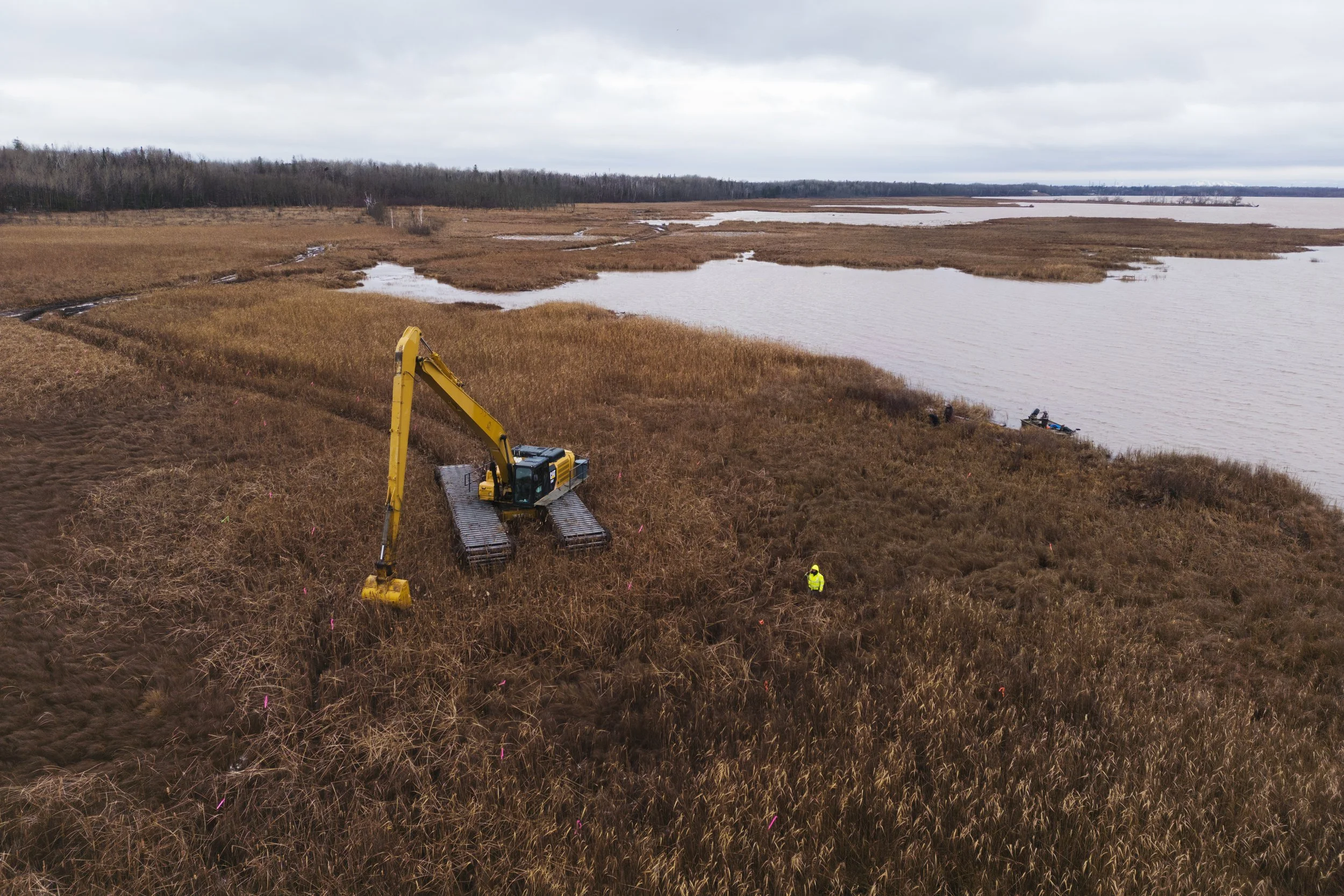
Allouez Bay Marsh Bird Habitat Restoration (Phase 2)
Wetland Protection & Restoration
Allouez Bay historically was home to more wetland habitat, which has been converted to open water due in part to increased wave and wind exposure. This project is evaluating how installing shallow areas or small islands could reduce wave energy and wind exposure and help create conditions for more wetland habitat to thrive in the southeastern portion of Allouez Bay.
Funding: Great Lakes Restoration Initiative
Lead Project Partners: Wisconsin Department of Natural Resources, U.S. Army Corps of Engineers, Audubon Great Lakes
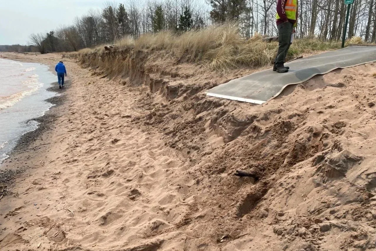
Wisconsin Point Resiliency Study and Visitor Use Assessment
High water levels in Lake Superior within the past decade have resulted in erosion and narrowing of Wisconsin Point shorelines. This study will gather scientific data and community input to inform recommendations for increasing the ability of Wisconsin Point to bounce back from high water levels and other impacts of a changing climate.
Current/Recent Improvement Projects
These improvements are helping make Wisconsin Point a refuge for residents and visitors in need of connection with nature, along with plants and animals who rely on these healthy ecosystems.
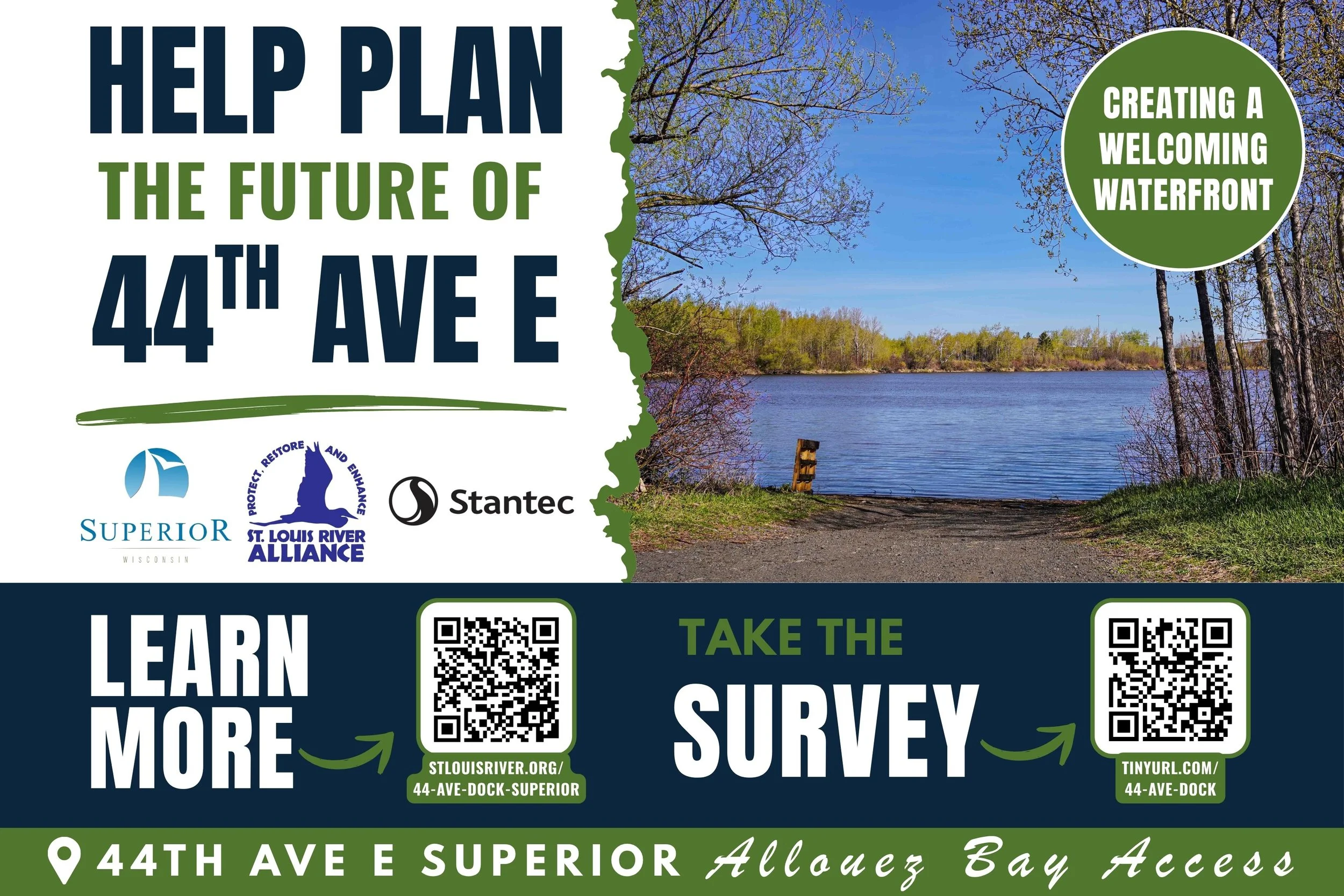
44th Avenue East Waterfront Access
The 44th Avenue East Waterfront Access Project (formerly known as Bunge Dock) is a community-driven effort to transform a former industrial dock on Allouez Bay into a safe, welcoming public waterfront space.
Project partners are currently in the planning phase and are gathering community input through events and an online survey to help shape the future of the site. Community feedback will guide future ideas for access, recreation, amenities, and overall use of the space. Please take the survey today!
Lead Project Partners: City of Superior, St. Louis River Alliance, Stantec
Learn More: City of Superior Project Page

Protect Dune Habitat & Improve Access
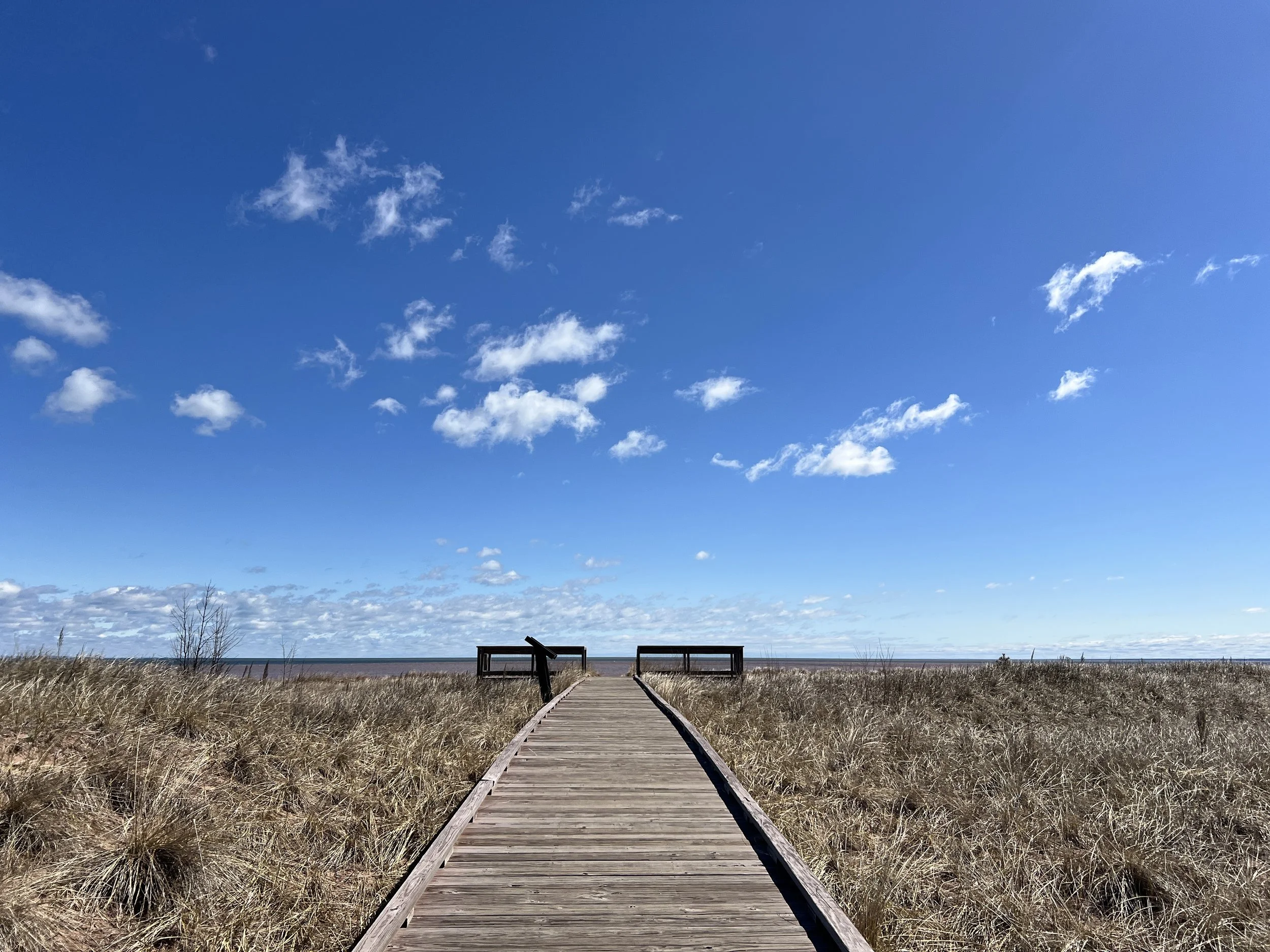
In 2019, Wisconsin Point was the focus for sensitive dune habitat protection and improved access. The City of Superior redesigned and consolidated parking into designated areas and installed boardwalks to guide foot traffic over the dunes. By concentrating access to specific points, the project helped restore and protect distributed dune areas. Additional amenities such as signage, restrooms, and trash and recycling receptacles were also installed.
Lead Project Partners: City of Superior
Learn More: Wisconsin Point Dune Restoration Fact Sheet

Makwa Ziibiins Miikana (Bear Creek Trail)
In 2020, the non-motorized, multi-use Makwa Ziibiins Miikana (Bear Creek Trail) opened. The trail connects the Osaugie Trail to Wisconsin Point via a crushed gravel path through the forest along Allouez Bay.
Lead Project Partners: City of Superior
Learn More: City of Superior Trails Page
Allouez Bay Manoomin Restoration
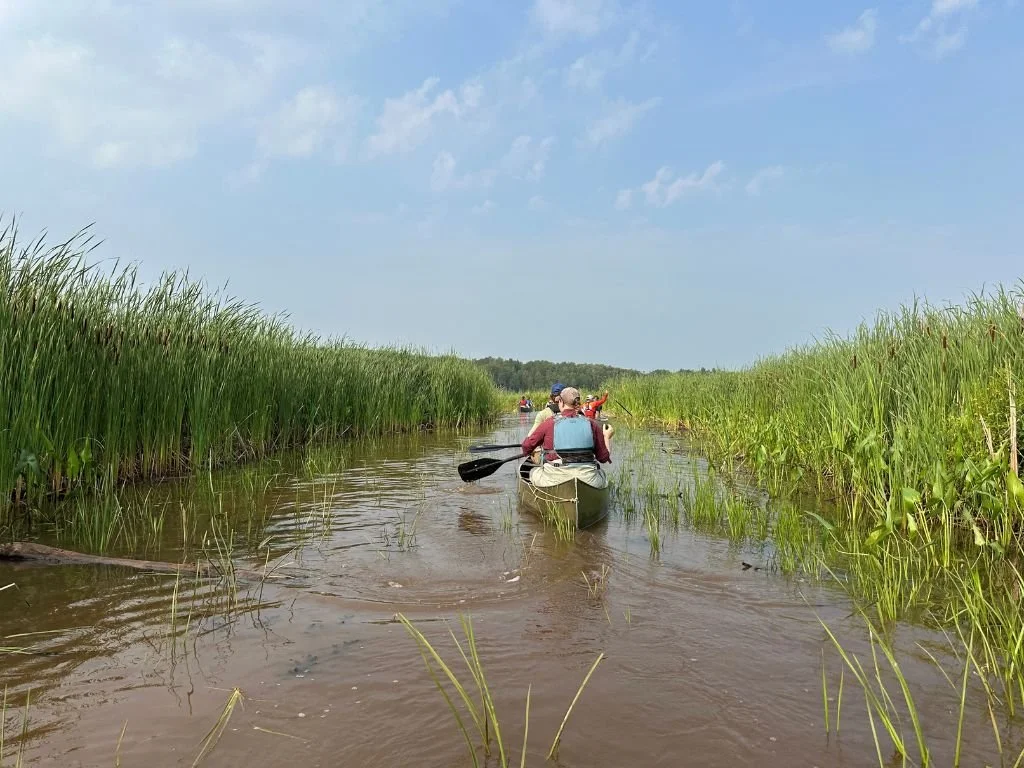
Since 2015, the Wisconsin DNR has been working to restore wild rice (manoomin, meaning “good berry” in Ojibwe) in the estuary as part of the Manoomin Restoration Partnership. Restoration efforts in Allouez Bay have included planting 5,971 pounds of rice seed, monitoring, protecting the rice from grazing geese, and conducting community outreach. Currently, the DNR is partnering with the St. Louis River Alliance to plant rice with volunteers in Allouez Bay.
Manoomin restoration is a long-term effort, and after ten years, we are now seeing wild rice returning to Allouez Bay.
Funding: Great Lakes Restoration Initiative
Lead Project Partners: 1854 Treaty Authority, Fond du Lac Band of Lake Superior Chippewa, Great Lakes Indian Fish and Wildlife Commission, St. Croix Band of Lake Superior Chippewa, St. Louis River Alliance, Douglas County, Ducks Unlimited, Lake Superior Research Institute, Minnesota Land Trust, Minnesota Department of Natural Resources, Minnesota Pollution Control Agency, Wisconsin Department of Natural Resources
Fact Sheet: Wild Rice Restoration Fact Sheet

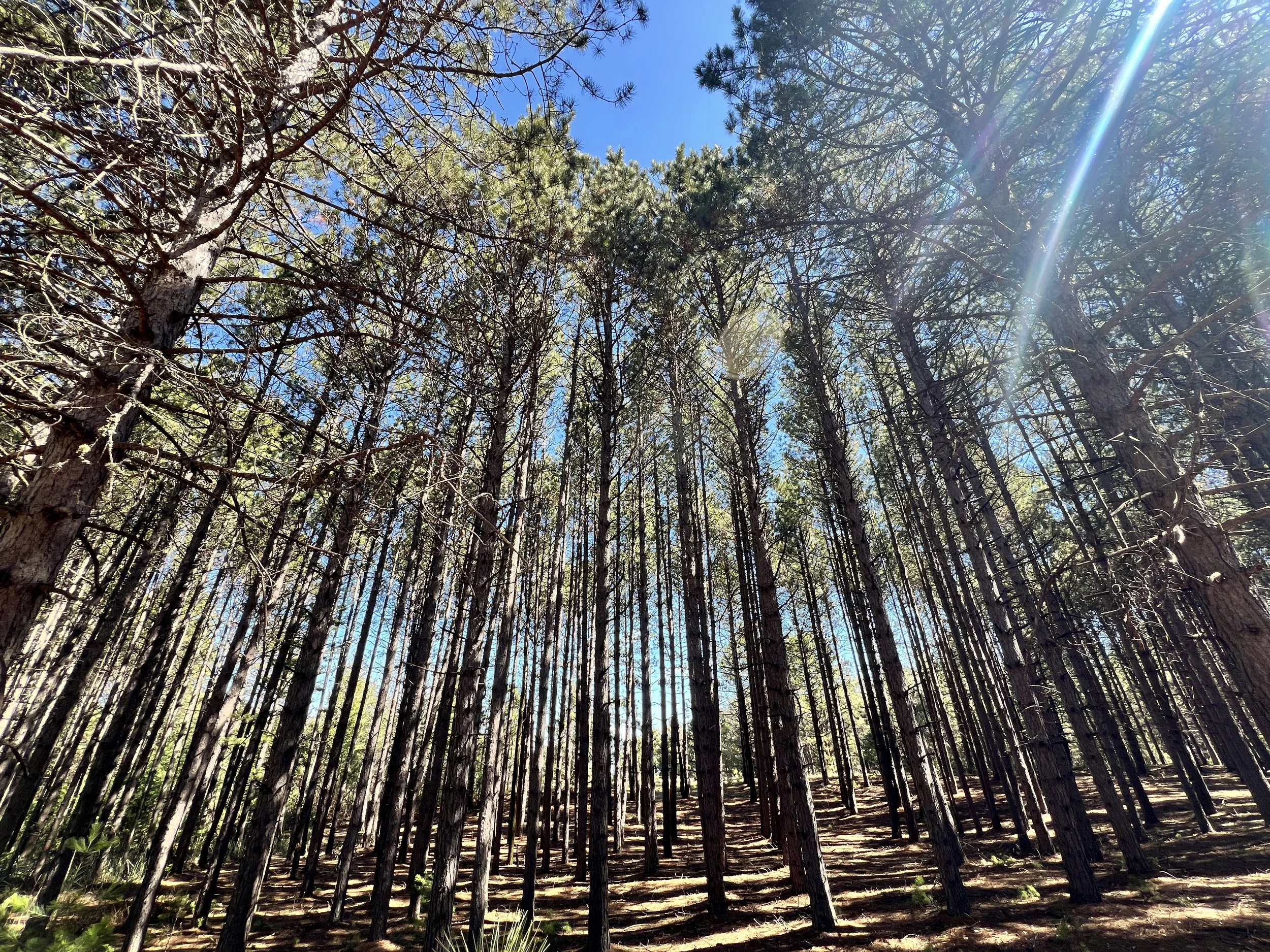
Returning Fire to Wisconsin Point
Currently there are efforts underway to return fire, or Ishkode in Ojibwemowin, to Wisconsin Point. Cultural fire practices were applied for generations by the Ojibwe on Wisconsin Point to manage healthy forest ecosystems and promote wildlife and growth of key foods and medicinal plants. Guided by best scientific and cultural practices, future prescribed cultural burns will help clear invasive species, return nutrients to the soil, help native plants thrive, and reduce wildfire risks.
Lead Project Partners: Fond du Lac Band of Lake Superior Chippewa, City of Superior, Lake Superior National Estuarine Research Reserve, Nature Conservancy
Learn More: City of Superior Wisconsin Point Fire Restoration Project Page
Wisconsin Point Bird Sanctuary Piping Plover Restoration
In 2019, construction was completed at the Wisconsin Point Bird Sanctuary to expand the sandy beach and install cobble nesting areas for the Great Lakes piping plover, a federally endangered species, with the goal of encouraging it to nest in the estuary once again. The site is protected from visitors during the nesting season, and partners work together to manage the habitat by removing woody debris and invasive species, as well as monitoring the plovers throughout the nesting period.
Funding: Great Lakes Restoration Initiative
Lead Project Partners: Wisconsin Department of Natural Resources, U.S. Army Corps of Engineers, U.S. Fish and Wildlife Service, St. Louis River Alliance
Learn More: Piping Plover Habitat Restoration Fact Sheet
Get Involved
There are many ways you can get involved in helping protect and restore these places!
River Activities Questionnaire
The St. Louis River Alliance is planning future events at Wisconsin Point and Allouez Bay to help folks visit and enjoy the area. Fill out our 5-minute River Activities Questionnaire to share how you’d like to connect with and experience Wisconsin Point and Allouez Bay.

Join Us at an Event!
The St. Louis River Alliance will be tabling and hosting multiple events throughout the year to help connect the community to the various restoration projects. Check out our Event Calendar to see what’s coming next!