
Explore the St. Louis River
Welcome to the St. Louis River, the headwaters of the Great Lakes.
Known to local Anishinaabe as Gichigami ziibi, “the river that flows into the great waters”, this is the home to the world’s largest freshwater estuary.
This place holds a rich and layered human history. For thousands of years, the river has been home to Native American communities and life ways, followed later by European explorers, missionaries, and settlers, and today, by all of us who live, work, and recreate here.
For centuries, human hands have affected the river. Trapping, logging, quarrying, shipping, and steelmaking made permanent changes within the landscape. Yet the river endures. Its wetlands, bays, and shorelines remain a remarkably productive haven for birds, fish, and mammals.
Along the river’s edges, industry and green shoreline exist side by side, a visible reminder that people have always been part of this place. The St. Louis River’s story is one of change, resilience, and responsibility, connecting its past, present, and future in a dynamic and living system.
This website page focuses on the lower St. Louis River estuary, the portion of the river that begins at the Fond du Lac Dam and extends to Lake Superior. This dynamic stretch includes the river’s freshwater estuary, industrial harbor, and coastal wetlands, and highlights the place where river, community, and lake come together.
Location
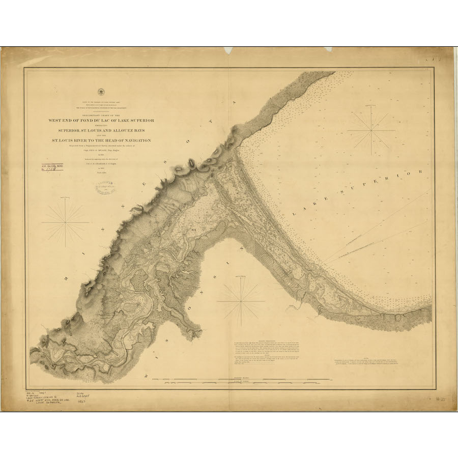
The St. Louis River, the largest U.S. tributary to Lake Superior, drains 3,634 square miles, entering the southwestern corner of Lake Superior between Duluth, Minnesota, and Superior, Wisconsin. The river flows 179 miles, passing through diverse landscapes that reflect its glacial history - from coarse soils, glacial till, and outwash deposits at its headwaters, to the deep, narrow gorge at Minnesota’s Jay Cooke State Park, and the red clay soils in its lower reaches.
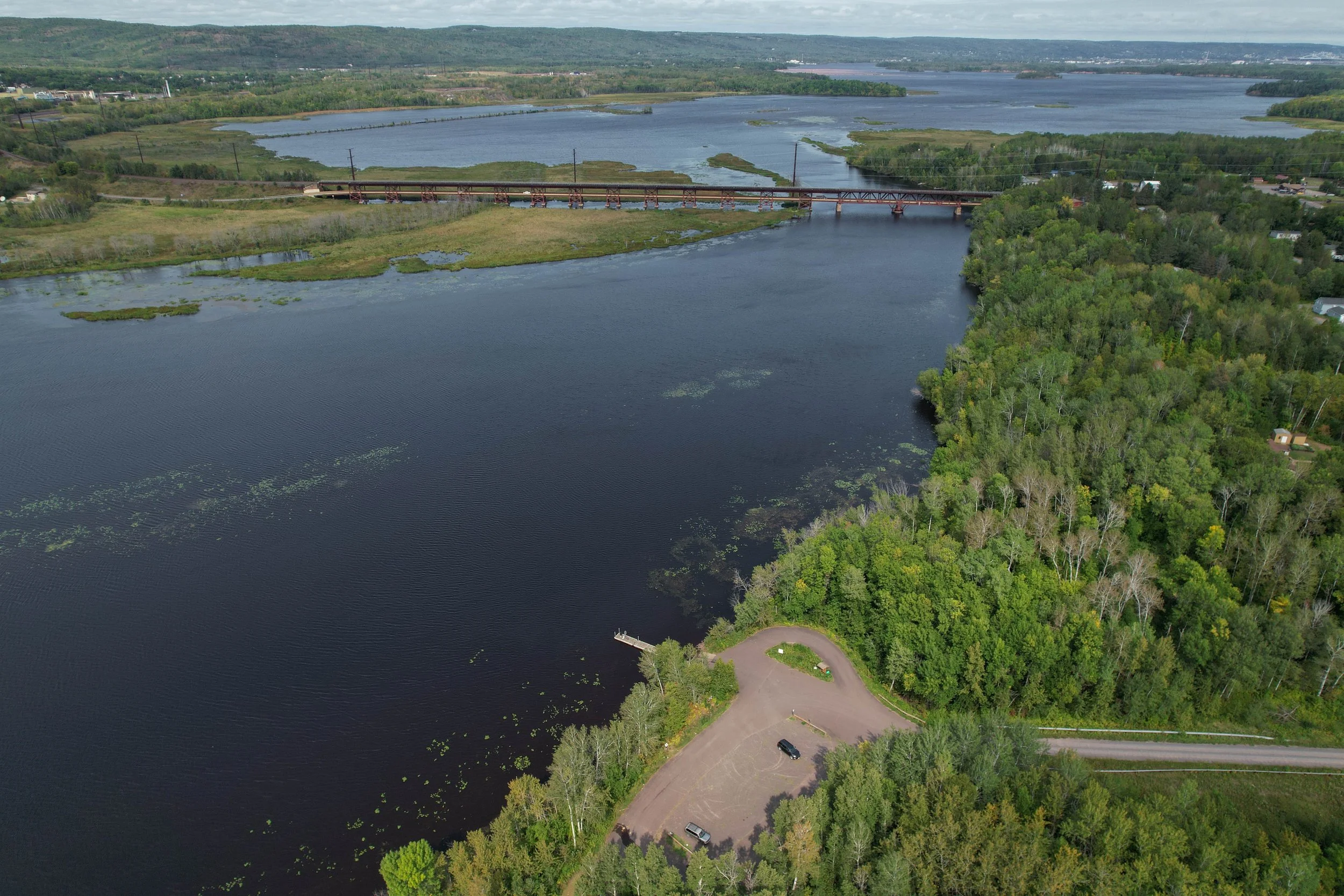
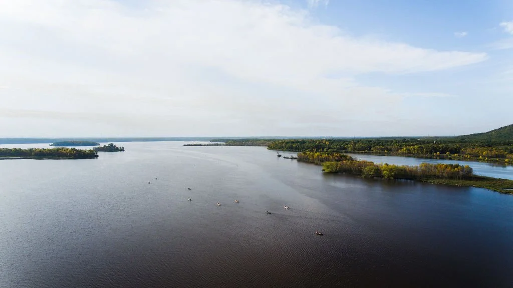
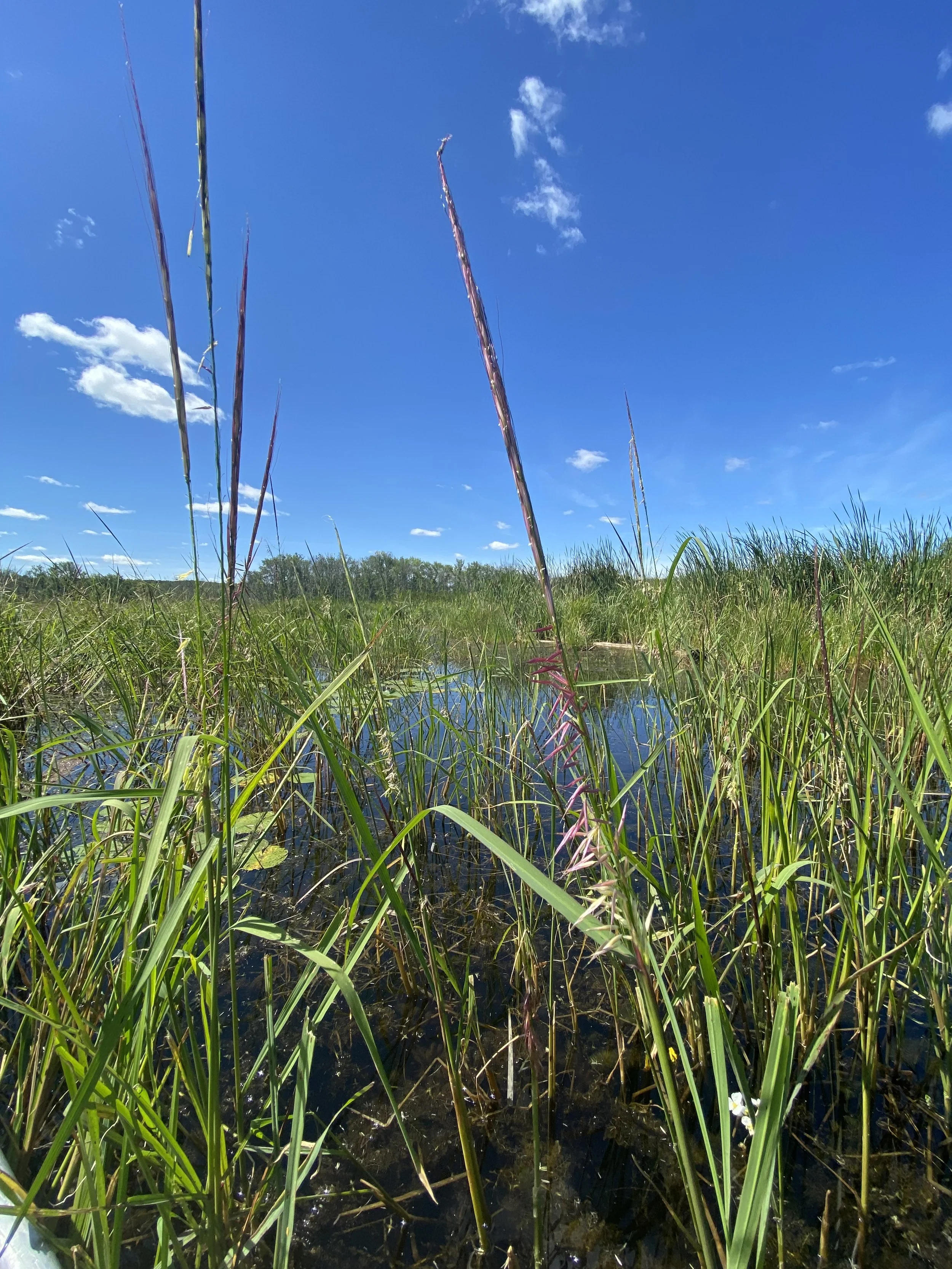
Below the Fond du Lac Dam, the river slows and spreads out as it approaches Lake Superior, forming a 12,000-acre freshwater estuary. This estuary marks the transition between river and lake, where flowing waters meet sheltered bays, wetlands, and coastal habitats.
The upper estuary has some wilderness-like areas, while urban development, an industrial harbor and a major port characterize the lower estuary. The lower estuary includes St. Louis Bay, Superior Bay, Alleouz Bay, and the lower Nemadji River. The estuary’s active harbor is the largest and busiest on the Great Lakes and one of the leading bulk-cargo ports in North America.
Due to historical industrial pollution, the St. Louis River Estuary was designated an Area of Concern (AOC) by the International Joint Commission under the U.S.–Canada Great Lakes Water Quality Agreement. Areas of Concern are locations across the Great Lakes that were heavily polluted by past practices of dumping untreated waste on land and into waterways.
Cleanup and restoration of the estuary are guided by the St. Louis River System Remedial Action Plan (RAP), a collaborative effort focused on improving water quality, habitat, and overall ecosystem health. The RAP began in 1989 through a partnership between the Minnesota Pollution Control Agency and the Wisconsin Department of Natural Resources. As part of this work, a Citizens Advisory Committee was formed, which later incorporated as an independent nonprofit organization now known as the St. Louis River Alliance. Many of the original citizen and agency partners remain actively involved in restoration efforts today.
History of the Lower St. Louis River
-

Geologic History
The lower St. Louis River was shaped by ancient Canadian Shield bedrock and the advance and retreat of glaciers during the last Ice Age. As glaciers melted and the land rebounded, Lake Superior flooded the river valley, forming today’s freshwater estuary and sheltered harbor.
-
Natural History
This remarkably diverse estuary is shaped by red clay soils, rising Lake Superior water levels, and protective baymouth sand bars that create sheltered bays and rare Great Lakes wetland habitats. Despite significant wetland loss and dredging since the 1800s, it continues to support rich plant and wildlife communities, including dozens of fish species and critical habitat for birds and other wildlife.
-
Human History
The Fond du Lac region, long known as the “Head of the Lakes,” has been a center of Indigenous life, trade, and travel for thousands of years, with Anishinaabeg communities sustaining villages, seasonal camps, and trade routes along the St. Louis River. Beginning in the 1600s, European exploration, fur trading, missionary activity, and later transportation and settlement reshaped the area, laying the groundwork for the development of the Twin Ports.
-

Industrial History
The Lake Superior and Mississippi Railroad and the industries that followed transformed the St. Louis River corridor into a major transportation, manufacturing, and shipping hub, driving rapid growth in Duluth and Superior. Railroads, bridges, logging, mining, shipbuilding, and port development reshaped both the river and the region, leaving lasting economic benefits alongside environmental challenges now being addressed through restoration and cleanup efforts.
Habitat
The lower St. Louis River supports diverse habitats shaped by natural processes and human influences. Between the Fond du Lac Dam and Lake Superior, the river widens into a freshwater estuary where river and lake waters mix, providing nurseries for fish and wildlife, buffering storms, and filtering pollutants. Water depth, clarity, temperature, sediment, and nutrients all influence aquatic plants and animals, while seasonal rainfall and Lake Superior’s seiche—natural oscillations in water levels—further shape habitats. Surrounding uplands affect erosion and water quality, and wetlands, including marshes, wet meadows, shrublands, mudflats, seeps, and fens, offer food and shelter for fish, birds, mussels, and other species, many of which are unique to the Great Lakes region. Human activities such as dams, dredging, shoreline development, and runoff have altered the river, but these habitats remain vital and highly productive.
Flora/Fauna
-
Mammals
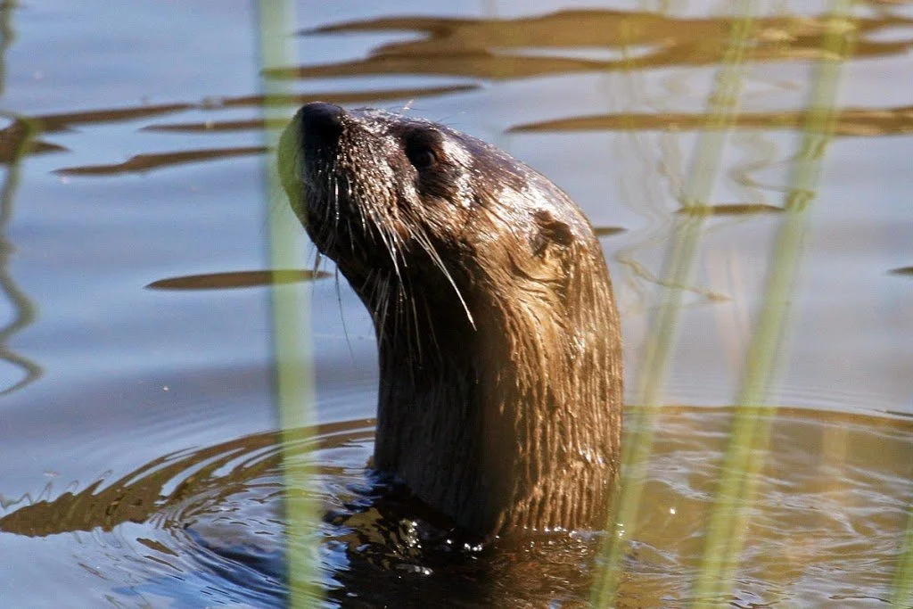
The St. Louis River corridor is home to a diverse array of mammals, from beavers and muskrats in wetlands to deer, bears, foxes, and coyotes in forests and uplands. Small mammals like squirrels, rabbits, and voles thrive along riverbanks, adding to the river’s rich wildlife.
-

Birds
The lower St. Louis River estuary is a vital habitat for over 230 bird species, serving as a key stopover for migrants and a breeding ground for many residents. Wetlands, sandy beaches, and open water provide food and shelter for songbirds, shorebirds, raptors, and waterbirds, including species of conservation concern like piping plovers and bald eagles.
Resources:
Duluth/Superior Birding Map -

Fish
The St. Louis River supports one of the most diverse warm-water fish communities in the Great Lakes region, with more than 45 native species thriving in its waters and estuary.
Resources:
Fishing Regulations Minnesota
Fishing Regulations Wisconsin
MDA’s Fish Consumption Guidance -
Flowering Plants
Cattails, black-eyed susans, clovers, water lilies, milkweed, indian paint-brush, smartweeds, wild rice, buttercups, wild iris, wild roses, arrowhead plants, fringed sedges, pickerel-weeds, trilliums and sumac are flowering plants located on or near the river.
Perhaps the most important plant in the estuary is manoomin (wild rice). Manoomin is a water quality indicator and provides important habitat for fish and wildlife. Help protect this precious resource by learning about St. Louis River Manoomin Restoration Partnership.
-

Trees
Pines such as the red, white, and jack are found along the river; along with white and red burr oaks; red, sugar and silver maples; balsam fir; black and white spruce; basswood; tamarack; white and black ash; quaking and big-toothed aspen; northern white cedar; and paper and yellow birch.
-
Mussels
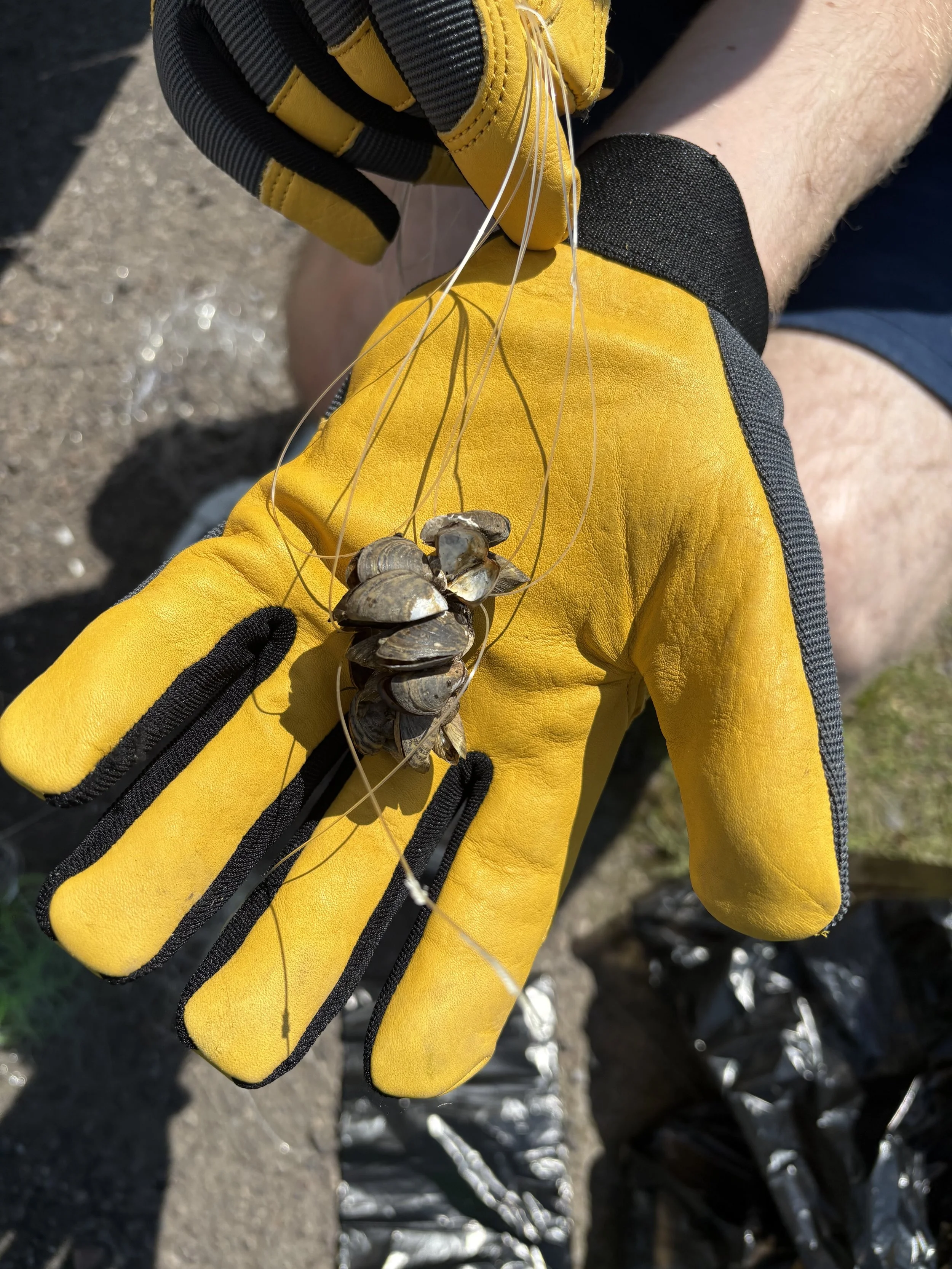
There are several native freshwater mussels found in the lower St. Louis River. Mussels require a firm substrate on which to attach; so far, they have only been documented in the stretch below the Fond du Lac dam, the dredged river channel and the industrial harbor flats. The lower St. Louis River was sampled for mussels in 2000, when eight native species were documented. Non-native zebra and quagga mussels were also present.
Environmental Challenges & Restoration
The St. Louis River is a vibrant ecosystem supporting wildlife, fisheries, and communities along its shores—but it faces ongoing environmental challenges. Historic industrial activity, urban runoff, and invasive species have left areas with contaminated sediments, degraded habitats, and altered shorelines. These issues affect water quality, fish and wildlife populations, and recreational opportunities.
Because of these historic impacts, the St. Louis River was designated as one of 31 U.S. Areas of Concern (AOC) on the Great Lakes. This designation identifies locations where environmental degradation is significant and targeted cleanup and restoration efforts are needed. The AOC process guides long-term remediation, habitat restoration, and monitoring projects in partnership with federal, state, and local agencies. Learn more about the St. Louis River Area of Concern process and progress here!
The St. Louis River Alliance (SLRA) plays a key role in connecting the community to these efforts. By sharing project updates, hosting engagement opportunities, and providing accessible ways for residents to contribute input, SLRA ensures local voices help shape the river’s future. Community members can stay informed about current and upcoming projects, public meetings, and volunteer opportunities by signing up for the SLRA newsletter.
Through collaboration between agencies, organizations, and residents, the St. Louis River is steadily recovering—becoming a healthier, safer, and more accessible place for both people and wildlife.
Safety & Recreation
The St. Louis River is a vibrant and diverse waterway offering countless ways to explore and enjoy the outdoors. From quiet, scenic stretches of the estuary to the active shipping harbor, the river supports a wide range of recreational activities for all ages and skill levels. Visitors can enjoy boating, kayaking, canoeing, paddleboarding, sailing, and motorized boating, as well as fishing, birdwatching, hiking along the shoreline, wildlife observation, and winter recreation in some areas. The river’s marshes, islands, and beaches also provide opportunities for photography, nature study, and family outings.
The St. Louis River is part of the St. Louis River Estuary National Water Trail, a federally designated trail that encourages safe, responsible access while highlighting the river’s ecological and cultural significance.
The St. Louis River Alliance designed this webpage with funding support provided by NOAA’s Office for Coastal Management (NA24NOSX419C0020) and the Minnesota Department of Natural Resources.