

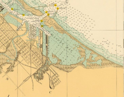
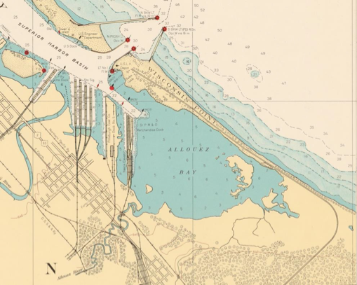
Allouez Bay
Marsh Bird Habitat Restoration
Project Goal
The Allouez Bay Marsh Bird Habitat Restoration project is a multi-phase effort to restore and protect wetlands in eastern Allouez Bay, providing improved habitat for marsh birds.
Allouez Bay, located in Superior, Wisconsin, is one of the few places in the Great Lakes region with strong potential to support thriving marsh bird populations. Historically, the bay contained extensive wetlands and wild rice beds, providing habitat for species such as black terns, yellow-headed blackbirds, and sedge wrens. Over the past century, dredging and shoreline construction increased wind and wave energy, causing wetlands to erode. In addition, invasive hybrid cattails spread across remaining wetlands, forming dense stands that crowded out native plant diversity. As a result, marsh bird populations have declined.
Despite these changes, Allouez Bay still contains high-quality wetland remnants and provides a unique opportunity for restoration. The Allouez Bay Marsh Bird Habitat Restoration project is a multi-phase project focusing on improving and protecting wetland habitat to support larger, healthier populations of marsh birds.
Phase 1 of this project consisted of restoring the patchwork wetland habitat that breeding marsh birds prefer by removing invasive plants and restoring native wetland vegetation.
Phase 2 of this project will help safeguard existing high-quality and restored marsh bird habitats while also supporting the expansion of wetland areas that provide food, shelter, and nesting grounds for marsh birds.
Continue reading for future details.
Phase 1
Phase 1 focused on improving habitat in existing wetland areas that had become dominated by invasive cattails.
Restoration work included:
Cutting dense cattail stands below the waterline to prevent regrowth
Creating narrow channels and small elevated mounds
Seeding restored areas with native wetland plants
These actions promote a natural mix of open water and native vegetation—the habitat structure marsh birds need to nest and forage. Phase 1 implementation was completed in Fall 2024, with ongoing monitoring and invasive cattail control continuing.
Fact Sheet: St. Louis River Estuary Allouez Bay Marsh Bird Habitat Restoration Project
2024 mechanical cattail removal.

2025 site visit to analyze native vegetation regrowth.

2025 partner paddle to visit channels and analyze native vegetation regrowth on created mounds.
What is the issue?
Great Lakes marsh bird populations have declined significantly over the past 30 years, largely due to habitat loss and the spread of invasive species, like invasive narrow leaf cattail and hybrid cattails. Several of the target bird species for this project, shown below, are listed as endangered or of special concern in Wisconsin due to habitat loss. Habitat modeling by Audubon Great Lakes identified Allouez Bay as one of the few places in the region with strong potential to support larger marsh bird populations. The bay still supports some breeding birds today, but only in low numbers. Because of this unique potential, Allouez Bay was selected as a priority site for habitat restoration to help these species rebound.

Image: Birds that will benefit from this project.
What is the difference between hybrid/invasive cattails and native cattails?
Broadleaf cattails (Typha latifolia) are a native wetland plant found throughout North America. These tall, sturdy plants support healthy wetlands by providing food and shelter for fish, birds, and other wildlife. They also help filter water, prevent erosion, reduce flooding, and store carbon.
Cattails have long been used by Indigenous peoples for food and weaving, and they have also been used in World War II efforts and in modern biofuel research.
However, problems arise with hybrid cattails, which are a mix of native broadleaf and non-native narrowleaf cattails. These hybrids grow faster, spread more aggressively, and can take over wetlands, pushing out native plants and wildlife. They form thick stands that reduce plant diversity and harm important species like manoomin (wild rice).
Hybrid cattails spread both by wind-blown seeds and underground roots called rhizomes (roots that grow horizontally) - making them very hard to control once they take hold.
You can learn more about cattails at: voyageurs.org/news/hybridcattails
What is being done?
This is the first phase of a multi-part effort to improve wetland habitat in Allouez Bay. Work in this phase targeted areas where invasive cattails had formed dense, uniform stands. In 2024, narrow channels were created and small mounds seeded with native wetland plants to restore the mix of open water and vegetation that marsh birds prefer. These features were placed in sheltered areas of the bay where they will withstand wind and wave action during major storm events.
In other areas, dense cattail stands were mowed below the waterline (2024). When cattails are cut underwater, they are suffocated and unable to survive. These areas were not reseeded; instead, they are expected to naturally recover as native plant seeds stored in the sediment germinate once competition from invasive cattail is reduced.
What is the project status?
The channel creation, pooling, and cattail mowing were completed in fall 2024, and reemerging cattails were cut in 2025. Going forward, field crews will continue to manage the site by removing any invasive or hybrid cattails that reemerge. Marsh bird monitoring will also be conducted over the next several years to assess how bird populations respond to the restored habitat.
Who is leading the project?
Project Leads: Audubon Great Lakes and Wisconsin Department of Natural Resources (DNR), in partnership with adjacent landowners, the City of Superior and Douglas County.
Project Partners: A large partner team is involved in evaluating the alternatives including the Fond du Lac Band of Lake Superior Chippewa, Minnesota Land Trust, University of Wisconsin–Superior, University of Minnesota Natural Resources Research Institute, St. Croix Band of Lake Superior Chippewa, Lake Superior National Estuarine Research Reserve, U.S. EPA Office of Research and Development.
Project Funding: Great Lakes Restoration Initiative
Questions?
Contact project lead: Molly Wick, Wisconsin DNR at Molly.wick@wisconsin.gov or 715-817-8510
Phase 2
The goal of Phase 2 is to increase protection for wetlands in eastern Allouez Bay by reducing wind and wave impact, helping to safeguard existing habitat and support the recovery of additional marsh bird wetland areas.
This work includes evaluating the feasibility of features such as small islands, mudflats, or shallow underwater shoals that can create sheltered, calm-water conditions where native wetland vegetation—and marsh bird habitat—can grow and thrive.
What is the issue?
Historically, Allouez Bay supported significantly more wetland habitat. Early European visitors described a wide shallow river with vegetation and wild rice so thick that the channel was hard to find. Over time, harbor dredging and construction of shipping piers increased wind and wave action in Allouez Bay, leading to a drastic reduction in wetland size. These changes have contributed to a decline in marsh bird populations. Despite this, the bay still contains remnant stands of high-quality wetlands, supporting diverse plant and animal communities and offering a strong foundation for restoration.
This is the second of a multi-phase project to improve marsh habitat in Allouez Bay. The objective of the project is to create sheltered conditions that both protects the existing high-quality wetlands and supports expansion of wetland conditions in the southeastern portion of Allouez Bay.
Below visuals: Series showing depleting vegetation in Allouez.
1825
1919
1863
1943
What is being done?
Partners are collaborating with engineers and modelers from the U.S. Army Corps of Engineers to explore ways to create sheltered habitat in the shallow southeastern portion of Allouez Bay, where wetlands historically existed. Several types of features are being considered, including small islands, mudflats at the water’s surface, and shallow underwater shoals. These features would be located in the eastern part of the bay, while the deeper central portion of the bay would remain open water to support fishing and open-water habitat. Each feature will be evaluated using wave-action models to ensure it can withstand storms and effectively create calm conditions behind it. Once a feature type is shown to be effective, the project will advance to the engineering design phase.
Image: One type of feature being evaluated is barchan dune features. These arc-shaped could be positioned in clusters that mimic natural features formed by wind blowing over sand.
What is the project status?
This project is currently in the concept design phase. This means that several different options are being evaluated using numerical modeling. This evaluation will be taking place in 2025 – 2026. If a type of feature is identified to be successful, the project will move into the technical design phase, starting in late 2026 or in 2027.
Who is leading this project?
Project Leads: Wisconsin Department of Natural Resources (DNR), in collaboration with the US Army Corps of Engineers leading modeling and technical support for the project. Adjacent landowners are the City of Superior and Douglas County.
Project Partners: A large partner team is involved in evaluating the alternatives including Audubon Great Lakes, Fond du Lac Band of Lake Superior Chippewa , Minnesota Land Trust, University of Wisconsin Superior, University of Minnesota Natural Resources Research Institute, St. Croix Band of Lake Superior Chippewa, Lake Superior National Estuarine Research Reserve, and US EPA Office of Research and Development.
Project Funding: Great Lakes Restoration Initiative
Questions?
Contact project lead: Molly Wick, Wisconsin DNR at Molly.wick@wisconsin.gov or 715-817-8510