
Historic Full-Day Paddle Itinerary: Chambers Grove & Red River Run
Exploring the St. Louis River Estuary National Water Trail
Activity: Full-Day Paddle
Route: Chambers Grove → Red River Run → Oliver Bridge → Chambers Grove
Launch Point: Chambers Grove Park
SLRE NWT Route: St. Louis River Excursion & Red River Run (Panel A & B)
Distance: 10-15 miles
Time: 6-8 hours depending on pace, wind, and weather conditions
Experience Level: Intermediate to Advanced depending on current
Trip Highlights: Start at Nagaajiwanaang (Chambers Grove Park), what once was the home of a great Ojibwe village. From here you’ll head to the calm, iron-rich Red River Run, and on the way back visit the historic Oliver Bridge. Spot wildlife along the way including eagles, herons, beavers, pelicans (migrating April-May) and muskrats, and witness the return of Lake Sturgeon spawning below the Fond du Lac Dam. A full-day adventure rich in history, culture, and nature!
Notes: Share your photos with us using #SLRENWT. Pack in, pack out. Please practice Leave No Trace principles!
Historic & Ecological Context
About three-quarters of a mile upstream from Chambers Grove lies a prominent bend in the river known to local Anishinaabe as Nagaajiwanaang, or “Where the Water Stops (Flowing).” This site was once home to a thriving Ojibwe village and has long been central to local Indigenous culture and life ways.
Chambers Grove itself became a popular picnic destination in the 1870s while home to Emily and Michael Chambers. From the 1880s through the 1940s, steam-powered excursion boats ferried visitors from downtown Duluth to this scenic riverside spot. After the 2012 floods, the park was reconstructed with a pavilion, grills, an interpretive trail, river access, and connections to the Duluth Traverse mountain bike trail.
Continuing along the paddle route, you’ll encounter the historic Oliver Bridge, a double-deck steel truss bridge built between 1910 and 1916 to carry rail traffic above and road traffic below, serving the region’s steel and iron-ore industries. Named for industrialist Henry Oliver, the bridge originally featured a swing-span to allow vessels to pass and has since been upgraded with reinforced decking for modern use.
Ecologically, the estuary has rebounded strongly. Lake Sturgeon, once eliminated from the estuary, now return each spring to spawn at the base of the Fond du Lac Dam, while the waters support abundant wildlife, from eagles and herons to beavers and muskrats, creating a rich, living connection to both the river’s cultural and natural history.
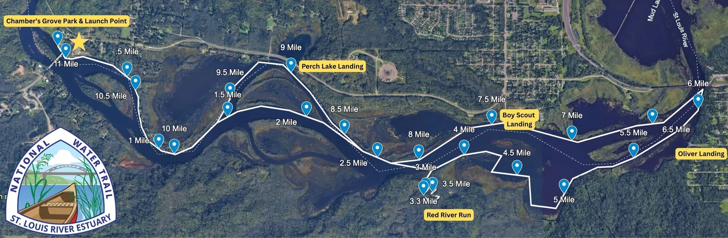
The above map was created on Google Earth and outlines a potential full-day paddle The gold stars indicates Chambers Grove Park as your launch point. The gold labels indicate various access points and highlights the Red River Run. Each blue marker indicates a .5 mile. This map should not be used for navigational purposes.

Drone image of Chambers Grove Park, upstream you can see the Fond du Lac Dam. Photo credit: Matthew Sperrazza.

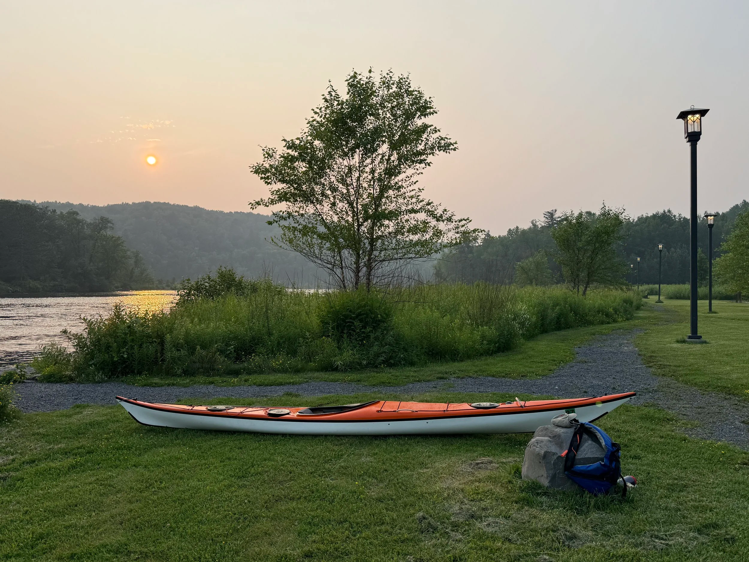
St. Louis River Estuary National Water Trail launching point at Chambers Grove.
Itinerary

Chambers Grove is a migratory stopping point for the American Pelicans, often seen April to May. Photo credit: Timothy Beaulier.
Launch at Chambers Grove (Nagaajiwanaang)
Start at this historic park with full amenities: restrooms, drinking water, shaded pavilions, picnic tables, a flat launching area, playground, parking, public orchard, and grills.Paddle to North Bay (3.5 miles)
Head downstream from Chambers Grove to North Bay, paddling under the Highway 23 bridge and taking in the estuary’s woodlands. Wildlife along this stretch may include great blue herons, osprey, and bald eagles. The first islands you pass will be Amik (Beaver) and Nigig (Otter) Island, once home to Ojibwe villages and a large garden.Enter the Red River Run
Turn south into the Red River Run, meandering along calm, iron-rich waters. Look for beavers, otters, muskrats, snapping turtles, dragonflies, and songbirds. Turn around when ready to continue toward Oliver Bridge.East to Oliver Bridge
Paddle east toward the historic Oliver Bridge. Stop at Boy Scout Landing or Oliver Landing for a restroom break or snack. Watch for mallards, mergansers, and herons fishing along the shoreline.Return to Chambers Grove (5.5 miles back)
Complete your loop by paddling back to Chambers Grove.
Notes & Safety
Downstream from the Fond du Lac Dam, this route is for Intermediate or Advanced paddlers
Currents below the dam can be strong; Minnesota Power alters water flow regularly—listen for alarms and watch river conditions
Expect rapids, shallow areas, and faster-moving water during spring runoff or after heavy rainfall
Bring safety gear and check river conditions before launching
Land Activities & Amenities
Chambers Grove Park offers both hiking, biking, birding, foraging, and picnicking opportunities. Its rich cultural history, natural beauty, and wildlife make it an ideal start and end point for a full-day paddle and extra adventuring. Chambers Grove Park provides a half-mile interpretive trail and access to the multi-use Duluth Traverse mountain bike trail, which stretches the length of the city. Hikers can enjoy the accessible gravel loop trail, which includes historical sites like an abandoned quarry and the first railroad bed built in Duluth. Mountain bikers can connect to the 42-mile-long Duluth Traverse from this park, which is part of a larger trail system maintained by the Cyclists of Gitchee Gumee Shores (COGGS).


The St. Louis River Alliance developed this itinerary using Federal funds under award NA24NOSX419C0020 from the Coastal Zone Management Act of 1972, as amended, administered by the Office for Coastal Management, National Oceanic and Atmospheric Administration (NOAA), U.S. Department of Commerce provided to the Minnesota Department of Natural Resources (DNR) for Minnesota’s Lake Superior Coastal Program.