
View & Download
St. Louis River Estuary National Water Trail Map
Click the individual panel you are interested below.
Once the new window pops open you can download the file to your device.
Please feel free to share on your social media and tag the St. Louis River Alliance in your River adventure photos/videos #SLRENWT
COVER
Cover, information about the St. Louis River Alliance

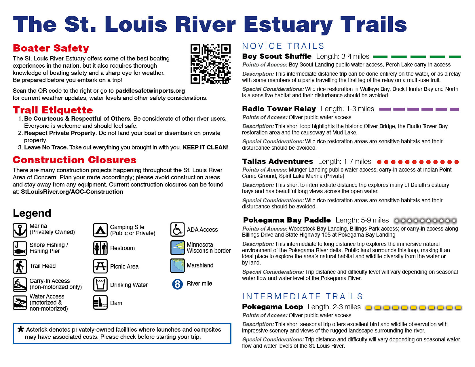
MAP INFO I
Safety, etiquette, legend, novice & intermediate trails
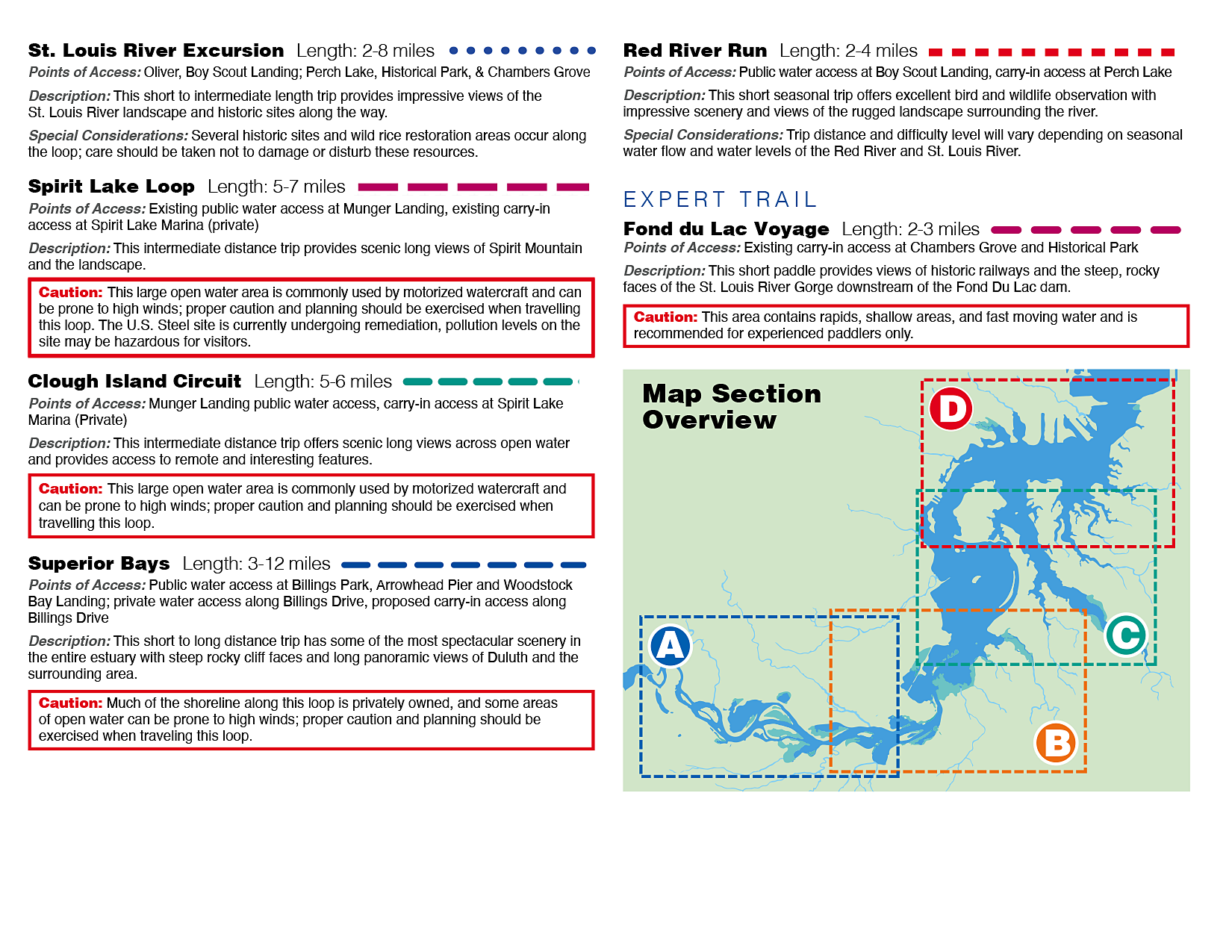
MAP INFO II
Intermediate & expert trails, legend, trail etiquette
PANEL A
Fond du Lac, Gary New Duluth

PANEL B
Little Pokegama Bay, Radio Tower Bay

PANEL C
Spirit Lake, Clough Island

PANEL D
Clough Island, Billings Park

INSIDE PANEL
Gold Sponsors

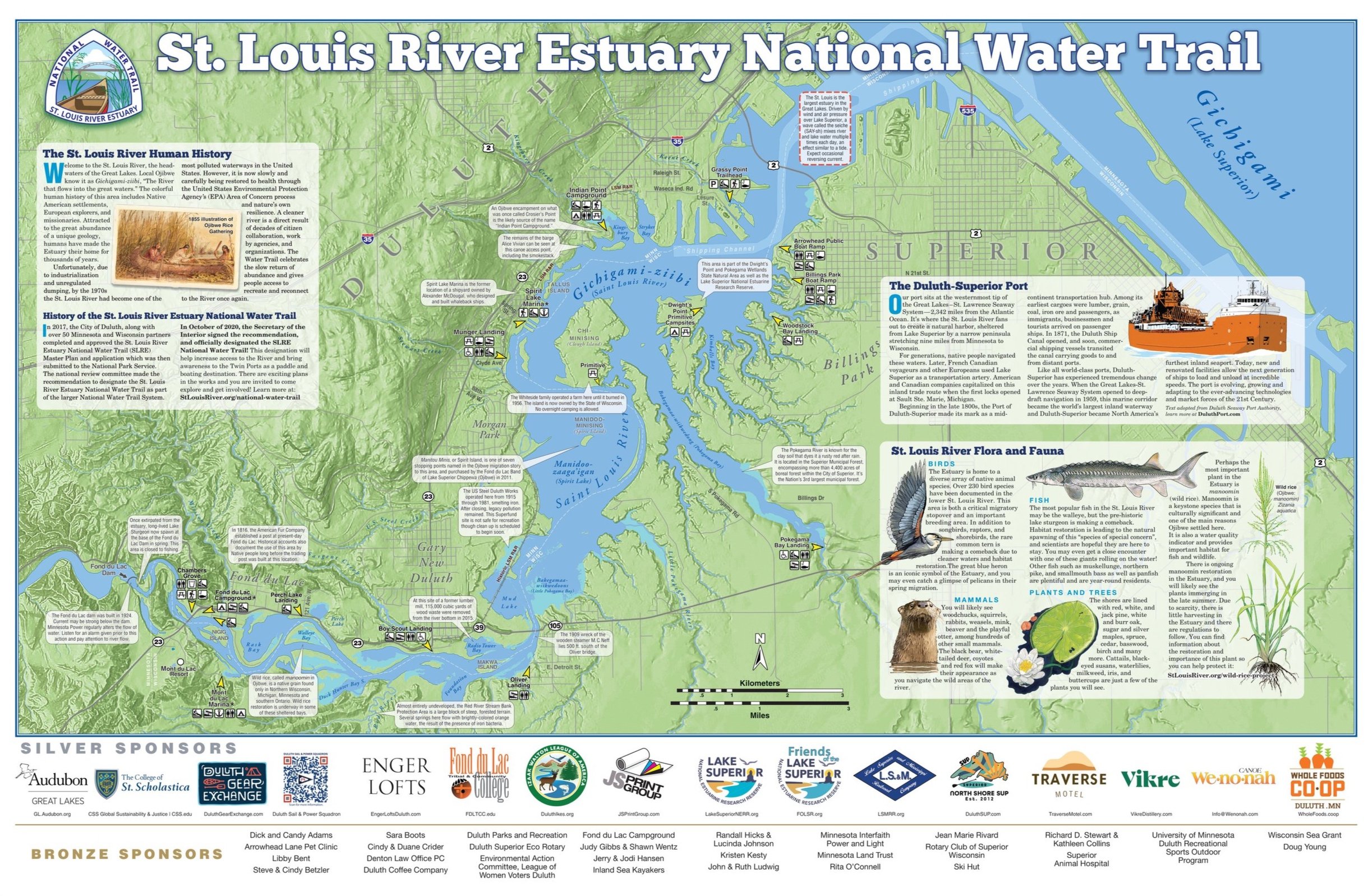
MAP OVERVIEW
Silver Sponsors, river history, flora/fauna
The St. Louis River Alliance prepared these National Water Trail Navigational Maps using Federal funds under award NA20NOS4190088 from the Coastal Zone Management Act of 1972, as amended, administered by the Office for Coastal Management, National Oceanic and Atmospheric Administration (NOAA), U.S. Department of Commerce provided to the Minnesota Department of Natural Resources (DNR) for Minnesota’s Lake Superior Coastal Program.